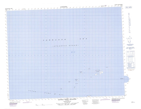
002E16 Little Fogo Islands Canada topo map, 1:50,000 scale
002E16 Little Fogo Islands NRCAN topographic map.
Includes UTM and GPS geographic coordinates (latitude and longitude). This 50k scale map is suitable for hiking, camping, and exploring, or you could frame it as a wall map.
Printed on-demand using high resolution, on heavy weight and acid free paper, or as an upgrade on a variety of synthetic materials.
Topos available on paper, Waterproof, Poly, or Tyvek. Usually shipping rolled, unless combined with other folded maps in one order.
- Product Number: NRCAN-002E16
- Parent Topo: TOPO-002E
- Map ID also known as: 002E16, 02E16, 2E16
- Unfolded Size: Approximately 26" high by 36" wide
- Weight (paper map): ca. 55 grams
- Map Type: POD NRCAN Topographic Map
- Map Scale: 1:50,000
- Geographical region: Newfoundland and Labrador, Canada
Neighboring Maps:
All neighboring Canadian topo maps are available for sale online at 1:50,000 scale.
Purchase the smaller scale map covering this area: Topo-002E
Spatial coverage:
Topo map sheet 002E16 Little Fogo Islands covers the following places:
- Back Cove - Big Garden Cove - Deans Harbour - Joe Batts Point Cove - Little Garden Cove - Puncheon Cove - Round Harbour - Sams Gulch - Wadhams Harbour - Eastern End - Big Gulch of Gunning Point - Big Head - Bill of Gunning Point - Bluff Point - Hawkins Point - Joe Batt's Point - Middle Gaze - Mullins Point - Norther Bill Point - Puncheon Cove Head - Amys Island - Bakeapple Island - Barrack Islands - Bishops Islet - Black Dog - Black Island - Browns Island - Cellar Island - Chaulks Island - Countryman Islands - Countryman Islets - Deans Harbour Puffin Island - Double Turr Cliff - Eastern Island - Fogo Island - Freakes Island - Gappy Island - Gappy Islet - Little Fogo Island - Little Fogo Islands - Little Gappy Island - Long Island - Long Islets - Mile Islet - Mile Rock - Northeast Island - Offer Stone Island - Pentons Island - Perlican - Prestons Island - Round Island - Seals Nest Islets - Single Turr Cliff - Steering Island - Storehouse Islets - The Nuddick - The Virgins - Turr Island - Turr Islets - West Countryman Island - White Island - Bishops Rock - Brogy Shoal - Drovers Rock - East Ice Ledge - Eastern Rock - Eastern Rocks - Elliot Spot - Green Bay Shoal - Gull Rock - Gunning Rock - Hard Hat - Harvey Rock - Ireland Rocks - Justegan Rock - Lanes Rocks - Lawrence Rock - Long Rocks - Middle Rock - Penny Rock - Red Rock - Rusty Rock - Storehouse Rocks - The Barracks - Turr Rocks - West Ice Ledge


