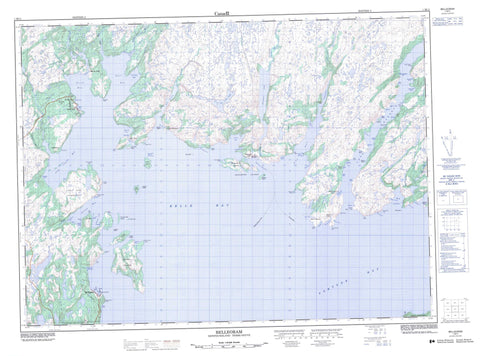
001M11 Belleoram Canada topo map, 1:50,000 scale
001M11 Belleoram NRCAN topographic map.
Includes UTM and GPS geographic coordinates (latitude and longitude). This 50k scale map is suitable for hiking, camping, and exploring, or you could frame it as a wall map.
Printed on-demand using high resolution, on heavy weight and acid free paper, or as an upgrade on a variety of synthetic materials.
Topos available on paper, Waterproof, Poly, or Tyvek. Usually shipping rolled, unless combined with other folded maps in one order.
- Product Number: NRCAN-001M11
- Parent Topo: TOPO-001M
- Map ID also known as: 001M11, 01M11, 1M11
- Unfolded Size: Approximately 26" high by 36" wide
- Weight (paper map): ca. 55 grams
- Map Type: POD NRCAN Topographic Map
- Map Scale: 1:50,000
- Geographical region: Newfoundland and Labrador, Canada
Neighboring Maps:
All neighboring Canadian topo maps are available for sale online at 1:50,000 scale.
Purchase the smaller scale map covering this area: Topo-001M
Spatial coverage:
Topo map sheet 001M11 Belleoram covers the following places:
- Andersons Cove - Back Cove - Belle Bay - Belle Harbour - Belleoram Barasway - Belleoram Harbour - Big Conne - Big Head Cove - Bitts Cove - Burdock Cove - Cinq Islands Bay - Cock and Hen Hole - Corbin Bay - Doctors Cove - Dog Cove - Doting Cove - Doting Cove - Doughball Cove - Duck Hole - Duck Hole - East Bay - Farmers Cove - Fortune Bay - Fox Cove - Grant Cove - Grundy Cove - Hare Harbour - Hatcher Arm - Hope Cove - Isle à Glu Cove - Jimmy Cove - Keeping Cove - Lakes Cove - Lally Back Cove - Lally Cove - Landing Cove - Little Bay - Little Conne - Lobster Cove - Long Cove - Long Harbour - Maggoty Cove - Magrath Cove - Mal Bay - Mooring Cove - North Bay - North West Arm - Northwest Cove - Parsons Cove - Pool's Cove - Rencontre Harbour - Rose Cove - Shellbird Cove - Shine Cove - Skinners Cove - South East Bight - South East Bight - South West Arm - Spyglass Cove - Stone Cove - The Ovens - Tickle Harbour - Tom Hole - Tranmer Cove - Turnip Cove - Yankee Cove - Tickle Beach - Back Cove Point - Bald Point - Beach Point - Big Head - Big Head - Bob Head - Cahill Point - Can Harbour Point - Cinq Islands Head - Conne Big Head - Corbin Head - Corbin Head Promontory - Doting Cove Head - Doting Head - East Bay Head - Farmers Cove Head - Friar Head - Grebe Head - Gull Point - Iron Head - Ironskull Point - Lally Head - Lobster Cove Point - Long Harbour Point - Long Point - Potato Point - Red Head - Round Point - Sandy Point - Seal Point - Thibauts Head - Tickle Head - Tilt Point - Witch Hazel Point - Woody Head - Belle Island - Chapel Island - Doctor Island - Dog Island - Gull Island - Herring Island - Indian Tea Island - Isle à Glu - Lally Cove Island - Long Island - Lord and Lady Island - Mal Bay Island - Petticoat Island - Rencontre Island - Rencontre Islands - Stearin Island - Thrum Cap - Tickle Island - Woody Island - Barachois du Barre - Femme Long Pond - Isle à Glu Pond - Rencontre Lake - Big Hill - Jimmy Pine Hill - Lakes Hill - Whalesback - Bay du Nord River - Crooked Brook - Duck Brook - Mal Bay Brook - Mare Brook - North East Brook - North West Brook - North West Brook - Rencontre Brook - Salmon River - Schooner Brook - Simmons Brook - South West Brook - Spout Brook - Back Cove Shoal - Barrow Rock - Black Rock - Chapel Island Rock - Cockup Shoal - Deep Water Ledge - Doting Cove Shoal - Ducie Rock - Dun Fish Shoal - Femme Shoal - Gangway Shoal - Grandy Rock - Gull Rock - Halibut Ledge - Hare Rock - Ironskull Bank - Little Shoal - Long Harbour Bank - Long Point Rock - Middle Ground - Northward Rock - Open Cove Shoal - Pennell Shoal - Pilot Rock - Roses Bank - Scrape Shoal - Seal Rocks - Shag Rock - South East Shoal - Stones Rock - Thoroughfare Shoal - Western Shoal - White Rock - Witch Hazel Rock - Belleoram - Pool's Cove - Rencontre East - Anderson's Cove - Bay du Nord - Corbin - Doctors Harbour - Hare Harbour - Hoop Cove - Lally Cove - Stone's Cove - Turnip Cove


