
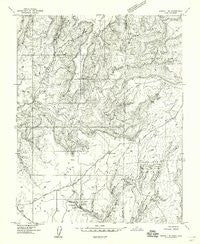
~ Aneth 1 NE UT topo map, 1:24000 scale, 7.5 X 7.5 Minute, Historical, 1957, updated 1958
Aneth 1 NE, Utah, USGS topographic map dated 1957.
Includes geographic coordinates (latitude and longitude). This topographic map is suitable for hiking, camping, and exploring, or framing it as a wall map.
Printed on-demand using high resolution imagery, on heavy weight and acid free paper, or alternatively on a variety of synthetic materials.
Topos available on paper, Waterproof, Poly, or Tyvek. Usually shipping rolled, unless combined with other folded maps in one order.
- Product Number: USGS-5958121
- Free digital map download (high-resolution, GeoPDF): Aneth 1 NE, Utah (file size: 11 MB)
- Map Size: please refer to the dimensions of the GeoPDF map above
- Weight (paper map): ca. 55 grams
- Map Type: POD USGS Topographic Map
- Map Series: HTMC
- Map Verison: Historical
- Cell ID: 38911
- Scan ID: 247904
- Imprint Year: 1958
- Aerial Photo Year: 1955
- Datum: Unstated
- Map Projection: Unstated
- Preliminary map: Yes
- Map published by United States Geological Survey
- Keywords: Nonstandard Press Run
- Map Language: English
- Scanner Resolution: 600 dpi
- Map Cell Name: Ruin Point
- Grid size: 7.5 X 7.5 Minute
- Date on map: 1957
- Map Scale: 1:24000
- Geographical region: Utah, United States
Neighboring Maps:
All neighboring USGS topo maps are available for sale online at a variety of scales.
Spatial coverage:
Topo map Aneth 1 NE, Utah, covers the geographical area associated the following places:
- Square Tower Canon - Hackberry Canyon - Horseshoe House - Eroded Bowlder House (historical) - Holly House - Ruin Point - Square Tower (historical) - Little Ruin Canyon - Hovenweep Ranger Station - Unit Type House (historical) - Spook Canyon - Little Cajon Lake - Hackberry Group - Square Tower Ruins Campground - Hovenweep Castle (historical) - Squaw Canyon - Ruin Point - Squaw Canyon - Hackberry Ruins - Twin Towers (historical) - Stronghold House (historical) - Hovenweep National Monument - Round Tower - McLean Basin - Hovenweep National Monument - Cajon Lake - Square Tower Group Ruins
- Map Area ID: AREA37.537.375-109.125-109
- Northwest corner Lat/Long code: USGSNW37.5-109.125
- Northeast corner Lat/Long code: USGSNE37.5-109
- Southwest corner Lat/Long code: USGSSW37.375-109.125
- Southeast corner Lat/Long code: USGSSE37.375-109
- Northern map edge Latitude: 37.5
- Southern map edge Latitude: 37.375
- Western map edge Longitude: -109.125
- Eastern map edge Longitude: -109


