
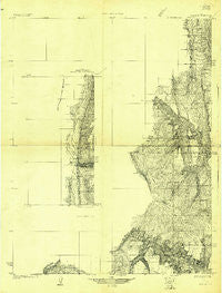
~ Wasatch UT topo map, 1:31680 scale, 15 X 15 Minute, Historical, 1922
Wasatch, Utah, USGS topographic map dated 1922.
Includes geographic coordinates (latitude and longitude). This topographic map is suitable for hiking, camping, and exploring, or framing it as a wall map.
Printed on-demand using high resolution imagery, on heavy weight and acid free paper, or alternatively on a variety of synthetic materials.
Topos available on paper, Waterproof, Poly, or Tyvek. Usually shipping rolled, unless combined with other folded maps in one order.
- Product Number: USGS-5686851
- Free digital map download (high-resolution, GeoPDF): Wasatch, Utah (file size: 20 MB)
- Map Size: please refer to the dimensions of the GeoPDF map above
- Weight (paper map): ca. 55 grams
- Map Type: POD USGS Topographic Map
- Map Series: HTMC
- Map Verison: Historical
- Cell ID: 64255
- Scan ID: 252663
- Survey Year: 1922
- Datum: NAD
- Map Projection: Polyconic
- Advance: Yes
- Map published by United States Geological Survey
- Keywords: Nonstandard Press Run; Inset
- Map Language: English
- Scanner Resolution: 600 dpi
- Map Cell Name: Wasatch
- Grid size: 15 X 15 Minute
- Date on map: 1922
- Map Scale: 1:31680
- Geographical region: Utah, United States
Neighboring Maps:
All neighboring USGS topo maps are available for sale online at a variety of scales.
Spatial coverage:
Topo map Wasatch, Utah, covers the geographical area associated the following places:
- Snow Lake - The Kitchen - Jet Fox Reservoir - Ferron Canyon Campground - Lone Tree - Wrigley Springs Reservoir - Black Dragon Creek - Twelve Mile Campground - The Cove - Heliotrope Mountain - Cove Mountain - Stinking Spring - Last Water - South Sage Flat - Water Terrace - Henningson Reservoir - Duck Fork Reservoir - White Mountain - Slide Fork - Currant Creek - Scab Hollow - Horse Creek - Gulch Creek - Little South Fork Manti Canyon - Mud Spring - Horn Mountain Cow Camp - Big Bear Creek - Dairy Point - Cold Creek - Box Canyon - Ferron Campground - Wrigley Creek - Lizard Lake - Petes Creek - Wrigley Spring - Oleys Lakes - Blue Lake - Slide Hollow - Jason Cabin - Buck Ridge - Lake Fork - Stevens Creek - Steves Creek Administrative Site - Wrigley Springs Dam - Ferron Mountain - Block Mountain - Lone Pine Spring - Willow Creek - Mill Stream - Manti-LaSal National Forest - Georges Fork - Julius Flat Dam - Wileys Fork - Black Fork Creek - Singleton Creek - Birch Creek - The Box - Julius Flat Reservoir - Heliotrope Point - Stevens Forest Service Facility - Singleton Flat - White Mountain Cabin - East Fork Box Canyon - Indian Creek - Petty Peak - Steamboat Point - North Fork Muddy Creek - Ferron Canyon Overlook - Little Bear Creek - Ferron Canyon - Jason Creek - Little Horse Creek - Willow Lake Dam - Lake Fork Creek - Shoemaker Flat - Horse Heaven - Cove Lake - Cowboy Creek - Windy Point - Willow Lake Campground - Elk Horn Flat - Henningson Dam - Brush Reservoir - Cove Creek - The White Slides - South Fork Muddy Creek - Harmonica Point - Duck Fork Reservoir - Spinners Dam - Emery Dam - Dairy Trail - Birch Spring - Spinners Reservoir - Greens Hollow - Ferron Campground - Black Mountain - Willow Bunch - McEwan Flat - The Narrows - Ferron Reservoir Campground
- Map Area ID: AREA39.2539-111.5-111.25
- Northwest corner Lat/Long code: USGSNW39.25-111.5
- Northeast corner Lat/Long code: USGSNE39.25-111.25
- Southwest corner Lat/Long code: USGSSW39-111.5
- Southeast corner Lat/Long code: USGSSE39-111.25
- Northern map edge Latitude: 39.25
- Southern map edge Latitude: 39
- Western map edge Longitude: -111.5
- Eastern map edge Longitude: -111.25


