
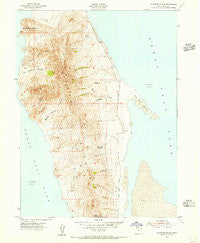
~ Antelope Island UT topo map, 1:24000 scale, 7.5 X 7.5 Minute, Historical, 1954, updated 1956
Antelope Island, Utah, USGS topographic map dated 1954.
Includes geographic coordinates (latitude and longitude). This topographic map is suitable for hiking, camping, and exploring, or framing it as a wall map.
Printed on-demand using high resolution imagery, on heavy weight and acid free paper, or alternatively on a variety of synthetic materials.
Topos available on paper, Waterproof, Poly, or Tyvek. Usually shipping rolled, unless combined with other folded maps in one order.
- Product Number: USGS-5677704
- Free digital map download (high-resolution, GeoPDF): Antelope Island, Utah (file size: 11 MB)
- Map Size: please refer to the dimensions of the GeoPDF map above
- Weight (paper map): ca. 55 grams
- Map Type: POD USGS Topographic Map
- Map Series: HTMC
- Map Verison: Historical
- Cell ID: 1140
- Scan ID: 247927
- Imprint Year: 1956
- Woodland Tint: Yes
- Aerial Photo Year: 1950
- Field Check Year: 1954
- Datum: NAD27
- Map Projection: Polyconic
- Map published by United States Geological Survey
- Map published by United States Army Corps of Engineers
- Keywords: Overedge
- Map Language: English
- Scanner Resolution: 600 dpi
- Map Cell Name: Antelope Island
- Grid size: 7.5 X 7.5 Minute
- Date on map: 1954
- Map Scale: 1:24000
- Geographical region: Utah, United States
Neighboring Maps:
All neighboring USGS topo maps are available for sale online at a variety of scales.
Spatial coverage:
Topo map Antelope Island, Utah, covers the geographical area associated the following places:
- Dooly Knob - Stringham Peak - Blackburn Spring - Daddy Stump Ridge - Buffalo Scaffold Canyon - Antelope Island - Garden Creek - Cedar Spring - Westside Spring - Freds Spring - Dry Canyon - Porcupine Spring - Sea Gull Point - Timely Gull Ridge - Dairy Springs - Bamberger Hill - Frary Peak - Frary Grave Site - The Sentry - Split Rock Bay - Dooly Spring - Mormon Rocks - Red Rocks - Picture Rock - Mushroom Springs - Elephant Head
- Map Area ID: AREA4140.875-112.25-112.125
- Northwest corner Lat/Long code: USGSNW41-112.25
- Northeast corner Lat/Long code: USGSNE41-112.125
- Southwest corner Lat/Long code: USGSSW40.875-112.25
- Southeast corner Lat/Long code: USGSSE40.875-112.125
- Northern map edge Latitude: 41
- Southern map edge Latitude: 40.875
- Western map edge Longitude: -112.25
- Eastern map edge Longitude: -112.125


