
~ Vernal UT topo map, 1:250000 scale, 1 X 2 Degree, Historical, 1954, updated 1974
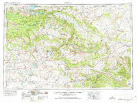
Vernal, Utah, USGS topographic map dated 1954.
Includes geographic coordinates (latitude and longitude). This topographic map is suitable for hiking, camping, and exploring, or framing it as a wall map.
Printed on-demand using high resolution imagery, on heavy weight and acid free paper, or alternatively on a variety of synthetic materials.
Topos available on paper, Waterproof, Poly, or Tyvek. Usually shipping rolled, unless combined with other folded maps in one order.
- Product Number: USGS-5463477
- Free digital map download (high-resolution, GeoPDF): Vernal, Utah (file size: 20 MB)
- Map Size: please refer to the dimensions of the GeoPDF map above
- Weight (paper map): ca. 55 grams
- Map Type: POD USGS Topographic Map
- Map Series: HTMC
- Map Verison: Historical
- Cell ID: 72253
- Scan ID: 252595
- Imprint Year: 1974
- Woodland Tint: Yes
- Aerial Photo Year: 1955
- Edit Year: 1965
- Datum: Unstated
- Map Projection: Transverse Mercator
- Map published by United States Army Corps of Engineers
- Map published by United States Army
- Map Language: English
- Scanner Resolution: 600 dpi
- Map Cell Name: Vernal
- Grid size: 1 X 2 Degree
- Date on map: 1954
- Map Scale: 1:250000
- Geographical region: Utah, United States
Neighboring Maps:
All neighboring USGS topo maps are available for sale online at a variety of scales.
Spatial coverage:
Topo map Vernal, Utah, covers the geographical area associated the following places:
- Flaming Gorge Lodge - Maeser - Elk Springs - Deer Lodge Summer Home Area - Jack Springs - Ouray - Manila - Blue Mountain - Bennett - Bonanza - Vernal - Naples - Robinson Place - Bullionville - Maybell - Roosevelt - Little Bonanza - Dinosaur - Greystone - Powder Wash - Hiawatha - Independence - Whiterocks - Sunbeam - Leeton - White River City - Gusher - Lapoint - Leota - Angora - Craig Place - Tridell - Fort Duchesne - Massadona - Wilson Place - Dry Fork - Hayden - Flaming Gorge Summer Home Area - Offield Place - Jensen - Rangely - Randlett - Dutch John - Ballard - Red Wash
- Map Area ID: AREA4140-110-108
- Northwest corner Lat/Long code: USGSNW41-110
- Northeast corner Lat/Long code: USGSNE41-108
- Southwest corner Lat/Long code: USGSSW40-110
- Southeast corner Lat/Long code: USGSSE40-108
- Northern map edge Latitude: 41
- Southern map edge Latitude: 40
- Western map edge Longitude: -110
- Eastern map edge Longitude: -108


