
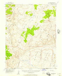
~ Wild Horse UT topo map, 1:62500 scale, 15 X 15 Minute, Historical, 1952, updated 1957
Wild Horse, Utah, USGS topographic map dated 1952.
Includes geographic coordinates (latitude and longitude). This topographic map is suitable for hiking, camping, and exploring, or framing it as a wall map.
Printed on-demand using high resolution imagery, on heavy weight and acid free paper, or alternatively on a variety of synthetic materials.
Topos available on paper, Waterproof, Poly, or Tyvek. Usually shipping rolled, unless combined with other folded maps in one order.
- Product Number: USGS-5463043
- Free digital map download (high-resolution, GeoPDF): Wild Horse, Utah (file size: 8 MB)
- Map Size: please refer to the dimensions of the GeoPDF map above
- Weight (paper map): ca. 55 grams
- Map Type: POD USGS Topographic Map
- Map Series: HTMC
- Map Verison: Historical
- Cell ID: 64535
- Scan ID: 252789
- Imprint Year: 1957
- Woodland Tint: Yes
- Aerial Photo Year: 1951
- Field Check Year: 1952
- Datum: NAD27
- Map Projection: Polyconic
- Map published by United States Geological Survey
- Map Language: English
- Scanner Resolution: 600 dpi
- Map Cell Name: Wild Horse
- Grid size: 15 X 15 Minute
- Date on map: 1952
- Map Scale: 1:62500
- Geographical region: Utah, United States
Neighboring Maps:
All neighboring USGS topo maps are available for sale online at a variety of scales.
Spatial coverage:
Topo map Wild Horse, Utah, covers the geographical area associated the following places:
- Horse Valley - Cowboy Camp - Bell Canyon - Baptist Draw - Bullberry Spring - McKay Flat - Hondu Country - East McKay Flat (historical) - Little Ocean Draw - Middle Wild Horse Mesa - Tomsich Butte - Cistern Canyon - The Chute - Little Wild Horse Canyon - Sy Butte - Reds Canyon - Salt Wash - Segers Hole - Chimney Canyon - Stinking Spring Creek - Keesle Country - Penitentiary Canyon - Cistern Tanks - Little Wild Horse Mesa - Salt Wash - Hunt Draw - Secret Springs - The Big Ridge - The Pasture - Bruff Valley - Salt Wash
- Map Area ID: AREA38.7538.5-111-110.75
- Northwest corner Lat/Long code: USGSNW38.75-111
- Northeast corner Lat/Long code: USGSNE38.75-110.75
- Southwest corner Lat/Long code: USGSSW38.5-111
- Southeast corner Lat/Long code: USGSSE38.5-110.75
- Northern map edge Latitude: 38.75
- Southern map edge Latitude: 38.5
- Western map edge Longitude: -111
- Eastern map edge Longitude: -110.75


