
~ Flat Canyon UT topo map, 1:62500 scale, 15 X 15 Minute, Historical, 1954, updated 1956
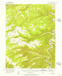
Flat Canyon, Utah, USGS topographic map dated 1954.
Includes geographic coordinates (latitude and longitude). This topographic map is suitable for hiking, camping, and exploring, or framing it as a wall map.
Printed on-demand using high resolution imagery, on heavy weight and acid free paper, or alternatively on a variety of synthetic materials.
Topos available on paper, Waterproof, Poly, or Tyvek. Usually shipping rolled, unless combined with other folded maps in one order.
- Product Number: USGS-5462443
- Free digital map download (high-resolution, GeoPDF): Flat Canyon, Utah (file size: 10 MB)
- Map Size: please refer to the dimensions of the GeoPDF map above
- Weight (paper map): ca. 55 grams
- Map Type: POD USGS Topographic Map
- Map Series: HTMC
- Map Verison: Historical
- Cell ID: 54165
- Scan ID: 249352
- Imprint Year: 1956
- Woodland Tint: Yes
- Aerial Photo Year: 1951
- Field Check Year: 1954
- Datum: NAD27
- Map Projection: Polyconic
- Map published by United States Geological Survey
- Map Language: English
- Scanner Resolution: 600 dpi
- Map Cell Name: Flat Canyon
- Grid size: 15 X 15 Minute
- Date on map: 1954
- Map Scale: 1:62500
- Geographical region: Utah, United States
Neighboring Maps:
All neighboring USGS topo maps are available for sale online at a variety of scales.
Spatial coverage:
Topo map Flat Canyon, Utah, covers the geographical area associated the following places:
- Sage Brush Flat - Elbow Spring - Petes Spring - Calf Canyon - Bishop Ridge - Wild Horse Canyon - Three Canyon Rapids - Flat Iron Mesa - Clay Bank Spring - Steer Ridge Canyon - Indian Swale - Flat Top - Buckskin Ridge - Twin Hollow - Snap Canyon - Bishop Canyon - Rock Creek - Calf Canyon Rapids - Pine Spring Draw - Bear Springs - Steer Ridge - Van Duesen Ridge - Tavapats Ranch Airport - Wild Horse Rapids - Pine Spring - Gooseneck Ridge - Left Fork Rock Creek - Big Swale - Log Cabin Rapids - Buckhorn Spring - Lunts Horse Pasture - Cottonwood Ridge - Rock Creek Rapids - Cedar Ridge - Rock Creek Ranch - Johnson Spring - Summerhouse Canyon - Willow Patch Spring - Summerhouse Ridge - Bear Canyon - Steer Ridge Bottom - Dry Farm Flat - Stone Cabin Creek - Buckskin Canyon - Snap Canyon Rapids - Horse Haven Summit - Cedar Corral Canyon - Indian Spring - Downard Spring - White Bear Spring - Steer Ridge Rapids - Spradling Spring - Stone Cabin Draw - Flat Top - Flat Canyon - Little Cedar Ridge Canyon - Pine Spring - Twin Springs Draw - Flat Canyon Rapids
- Map Area ID: AREA39.7539.5-110.25-110
- Northwest corner Lat/Long code: USGSNW39.75-110.25
- Northeast corner Lat/Long code: USGSNE39.75-110
- Southwest corner Lat/Long code: USGSSW39.5-110.25
- Southeast corner Lat/Long code: USGSSE39.5-110
- Northern map edge Latitude: 39.75
- Southern map edge Latitude: 39.5
- Western map edge Longitude: -110.25
- Eastern map edge Longitude: -110


