
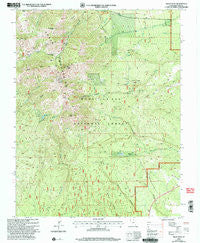
~ Abajo Peak UT topo map, 1:24000 scale, 7.5 X 7.5 Minute, Historical, 2001, updated 2004
Abajo Peak, Utah, USGS topographic map dated 2001.
Includes geographic coordinates (latitude and longitude). This topographic map is suitable for hiking, camping, and exploring, or framing it as a wall map.
Printed on-demand using high resolution imagery, on heavy weight and acid free paper, or alternatively on a variety of synthetic materials.
Topos available on paper, Waterproof, Poly, or Tyvek. Usually shipping rolled, unless combined with other folded maps in one order.
- Product Number: USGS-5455271
- Free digital map download (high-resolution, GeoPDF): Abajo Peak, Utah (file size: 16 MB)
- Map Size: please refer to the dimensions of the GeoPDF map above
- Weight (paper map): ca. 55 grams
- Map Type: POD USGS Topographic Map
- Map Series: HTMC
- Map Verison: Historical
- Cell ID: 20
- Scan ID: 247861
- Imprint Year: 2004
- Woodland Tint: Yes
- Aerial Photo Year: 1998
- Edit Year: 2001
- Datum: NAD27
- Map Projection: Lambert Conformal Conic
- Map published by United States Geological Survey
- Map published by United States Forest Service
- Map Language: English
- Scanner Resolution: 600 dpi
- Map Cell Name: Abajo Peak
- Grid size: 7.5 X 7.5 Minute
- Date on map: 2001
- Map Scale: 1:24000
- Geographical region: Utah, United States
Neighboring Maps:
All neighboring USGS topo maps are available for sale online at a variety of scales.
Spatial coverage:
Topo map Abajo Peak, Utah, covers the geographical area associated the following places:
- Dalton Trailer Camp - Jackson Camp - North Canyon - Dickson Gulch - Gold Queen Mine - Cold Springs Electronic Site - Dalton Spring Campground - Dickson Pass - Baker Guard Station - Camp Jackson Reservoir - Blue Mountain Ski Area - Camp Jackson Dam - Camp Jackson - Horsehead Peak - Blue Mountain Dude Ranch - Gold Queen Gulch - North Creek Pass - Dream Mine - Cooley Pass - Buckboard Flat - South Peak - Cold Springs - Cooley Gulch - Abajo Peak - Dream Mine - Jackson Ridge - Twin Peaks - North Peak - North Fork South Creek - North Fork Verdure Creek - Roundup Hollow - Gold Queen Basin
- Map Area ID: AREA37.87537.75-109.5-109.375
- Northwest corner Lat/Long code: USGSNW37.875-109.5
- Northeast corner Lat/Long code: USGSNE37.875-109.375
- Southwest corner Lat/Long code: USGSSW37.75-109.5
- Southeast corner Lat/Long code: USGSSE37.75-109.375
- Northern map edge Latitude: 37.875
- Southern map edge Latitude: 37.75
- Western map edge Longitude: -109.5
- Eastern map edge Longitude: -109.375


