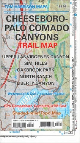
Cheeseboro-Palo Comado Canyons trail map
Shaded relief map printed on waterproof and tear resistant material. Scale 1:31,680 (1 inch representing 0.5 mil) This map includes the area North of the Zumas-Trancas Canyon Trail Map by the same cartographer. You may drive to it via 101 freeway and is of easy access. Features: Upper Las Virgines Canyon, Simi Hills, Oakbrook Park, North Ranch and Liberty Canyon. GPS Compatible. Complete UTM Grid.
- Product Number: TH_CHEESEBORO_12
- Reference Product Number: 2184435M
- ISBN: 9780981834443
- Date of Publication: 6/1/2012
- Folded Size: 8.27 inches high by 4.72 inches wide
- Unfolded (flat) Size: 23.23 inches high by 16.93 inches wide
- Map format: Folded
- Map type: Trade Maps - Hiking
- Geographical region: United States
- Geographical subregion: California