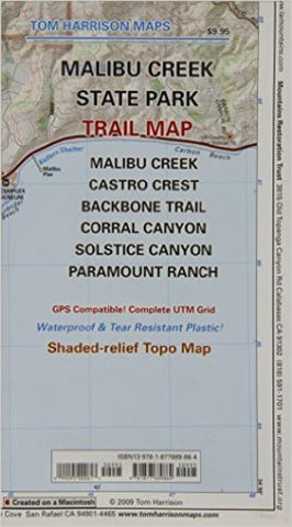
Malibu Creek State Park, California by Tom Harrison Maps
Folded topo trail map of Malibu Creek Park area. Covers Malibu Creek State Park. It includes Malibu Creek, Castro Crest, Corral Canyon, Backbone Trail, Solstice Canyon, and Paramount Ranch. The scale is 1:31,680 (1 inch represents 1/2 mile). Included are Ranger Stations, campgrounds, RV camps, picnic areas and much more. Waterproof, tear-resistant plastic material. Printed on one side.
- Product Number: 2033580M
- Product Code: TH_MALIBU_CR
- ISBN: 9781877689864
- Year of Publication: 2009
- Folded Size: 8.27 x 4.72 inches
- Unfolded Size: 23.23 x 17.72 inches
- Map type: Folded Map
- Geographical region: California