
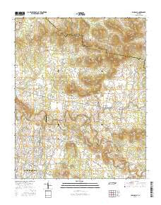
~ Lascassas TN topo map, 1:24000 scale, 7.5 X 7.5 Minute, 2016
Lascassas, Tennessee, USGS topographic map dated 2016.
Includes geographic coordinates (latitude and longitude). This topographic map is suitable for hiking, camping, and exploring, or framing it as a wall map.
Printed on-demand using high resolution imagery, on heavy weight and acid free paper, or alternatively on a variety of synthetic materials.
Topos available on paper, Waterproof, Poly, or Tyvek. Usually shipping rolled, unless combined with other folded maps in one order.
- Product Number: USGS-8017144
- Free digital map download (high-resolution, GeoPDF): Lascassas, Tennessee (file size: 25 MB)
- Map Size: please refer to the dimensions of the GeoPDF map above
- Weight (paper map): ca. 55 grams
- Map Type: POD USGS Topographic Map
- Map Series: US Topo
- Map Verison: Current
- Cell ID: 25028
- Datum: North American Datum of 1983
- Map Projection: Transverse Mercator
- Map Cell Name: Lascassas
- Grid size: 7.5 X 7.5 Minute
- Date on map: 2016
- Map Scale: 1:24000
- Geographical region: Tennessee, United States
Neighboring Maps:
All neighboring USGS topo maps are available for sale online at a variety of scales.
Spatial coverage:
Topo map Lascassas, Tennessee, covers the geographical area associated the following places:
- Bethel - Estes Acres - Fieldcrest - Delay Estates - Oak Hill - Two Hills - Fairfield Estates - Lascassas Colonial Acres - Emery Estates - Compton Meadows - Briarwood - Esquire Estates - Farmington Estates - Lascassas - Canebrake - New Las Casas (historical) - Browns Mill - Compton - Jerrerson Farms - Saint Johns - Valleyview - Oakland Estates - Lofton - Brian Manor - Riverwood
- Map Area ID: AREA3635.875-86.375-86.25
- Northwest corner Lat/Long code: USGSNW36-86.375
- Northeast corner Lat/Long code: USGSNE36-86.25
- Southwest corner Lat/Long code: USGSSW35.875-86.375
- Southeast corner Lat/Long code: USGSSE35.875-86.25
- Northern map edge Latitude: 36
- Southern map edge Latitude: 35.875
- Western map edge Longitude: -86.375
- Eastern map edge Longitude: -86.25


