
~ Cookeville TN topo map, 1:100000 scale, 30 X 30 Minute, Historical, 1944, updated 1944
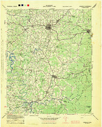
Cookeville, Tennessee, USGS topographic map dated 1944.
Includes geographic coordinates (latitude and longitude). This topographic map is suitable for hiking, camping, and exploring, or framing it as a wall map.
Printed on-demand using high resolution imagery, on heavy weight and acid free paper, or alternatively on a variety of synthetic materials.
Topos available on paper, Waterproof, Poly, or Tyvek. Usually shipping rolled, unless combined with other folded maps in one order.
- Product Number: USGS-5689650
- Free digital map download (high-resolution, GeoPDF): Cookeville, Tennessee (file size: 10 MB)
- Map Size: please refer to the dimensions of the GeoPDF map above
- Weight (paper map): ca. 55 grams
- Map Type: POD USGS Topographic Map
- Map Series: HTMC
- Map Verison: Historical
- Cell ID: 396078
- Scan ID: 149603
- Imprint Year: 1944
- Woodland Tint: Yes
- Edit Year: 1944
- Datum: NAD27
- Map Projection: Polyconic
- Map published by United States Army Corps of Engineers
- Map published by United States Department of War
- Map Language: English
- Scanner Resolution: 600 dpi
- Map Cell Name: Cookeville
- Grid size: 30 X 30 Minute
- Date on map: 1944
- Map Scale: 1:100000
- Geographical region: Tennessee, United States
Neighboring Maps:
All neighboring USGS topo maps are available for sale online at a variety of scales.
Spatial coverage:
Topo map Cookeville, Tennessee, covers the geographical area associated the following places:
- Twin Oak - Ridgecrest - Buck Mountain Estates - Heathwood - Wagonda Hills - McElroy - Nash - Lake Valley - Mount Pisgah - East Lake Estates - Walnut Grove - Shiloh - Bone Cave - Board Valley - Darwin Park - Westgate - Snow Mayberry Subdivision - Poinsettia Subdivision - Joppa - Candyland Estates - Cummingsville - River Hill - Pleasant Ridge - Bilbrey - Meade (historical) - Sligo (historical) - Bilbrey Park - Hickory Hills - Catlen - Pippen Springs Estates - Sand Springs - Darkey Springs - Findlay - Campbell - Mount Vernon Estates - Sparta Hills - Mountain Meadows - Post Oak Estates - College Heights - Selby (historical) - Cane Creek - Sweetgum - Ashcroft Subdivision - Forest Hills - Bunker Hill Park - Union Hill - Parragon - Marie White Subdivision - Quebeck - Eastwood - Horseshoe Falls (historical) - Hamptons Crossroads - Keltonburg - Rolling Acres - Bloomington Springs - Macedonia - Sun Valley - Maddux Farm - Drop (historical) - Campaign - Silver Point - Brotherton - Williams Crossroads - Center Point - Mount Vernon - The Lowlands - Cedar Hill - Black Oak - Hillsdale - Town and Country Estates - Dixieland - Sadler - Lafayette - Beaver Hill - Blackburn Hills Estates - Green Acres - Apple Valley Estates - Oaklawn - Poplar Grove - Colonial Estates - Gentry - Gibson Subdivision - Brandywine Estates - Jeremiah - Oakland - Dodson - Ditty - Elijah (historical) - Green Hills - Huntland - Yankeetown - Terry Subdivision - Jefferson - Hillwood - Colonial Acres - Lost Creek - Mill Creek - Pinhook (historical) - Marchbanks (historical) - Grandview
- Map Area ID: AREA36.2535.75-85.75-85.25
- Northwest corner Lat/Long code: USGSNW36.25-85.75
- Northeast corner Lat/Long code: USGSNE36.25-85.25
- Southwest corner Lat/Long code: USGSSW35.75-85.75
- Southeast corner Lat/Long code: USGSSE35.75-85.25
- Northern map edge Latitude: 36.25
- Southern map edge Latitude: 35.75
- Western map edge Longitude: -85.75
- Eastern map edge Longitude: -85.25


