
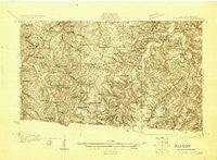
~ Lafayette TN topo map, 1:48000 scale, 15 X 15 Minute, Historical, 1928
Lafayette, Tennessee, USGS topographic map dated 1928.
Includes geographic coordinates (latitude and longitude). This topographic map is suitable for hiking, camping, and exploring, or framing it as a wall map.
Printed on-demand using high resolution imagery, on heavy weight and acid free paper, or alternatively on a variety of synthetic materials.
Topos available on paper, Waterproof, Poly, or Tyvek. Usually shipping rolled, unless combined with other folded maps in one order.
- Product Number: USGS-5678572
- Free digital map download (high-resolution, GeoPDF): Lafayette, Tennessee (file size: 10 MB)
- Map Size: please refer to the dimensions of the GeoPDF map above
- Weight (paper map): ca. 55 grams
- Map Type: POD USGS Topographic Map
- Map Series: HTMC
- Map Verison: Historical
- Cell ID: 56409
- Scan ID: 153364
- Survey Year: 1928
- Datum: NAD
- Map Projection: Polyconic
- Advance: Yes
- Map published by United States Geological Survey
- Keywords: Nonstandard Press Run
- Map Language: English
- Scanner Resolution: 600 dpi
- Map Cell Name: Lafayette
- Grid size: 15 X 15 Minute
- Date on map: 1928
- Map Scale: 1:48000
- Geographical region: Tennessee, United States
Neighboring Maps:
All neighboring USGS topo maps are available for sale online at a variety of scales.
Spatial coverage:
Topo map Lafayette, Tennessee, covers the geographical area associated the following places:
- Pleasant Hill - Barefoot - Green Valley - Amos - Oakdale - Brattontown - Walnut Hill - Siloam - Cross Roads - New Zion - Williams - Long Creek - Walnut Grove - Maple Grove - Forest Springs - Cross Lanes - White Plains (historical) - Rodemer - Gap of the Ridge - Wixtown - Eulia - Hayesville - Haysville - Pleasant Grove - Mount Union (historical) - Petroleum - Oak Forest - Mount Zion - Westmoreland - Fairview - Lafayette - Holland - Rocky Mound
- Map Area ID: AREA36.7536.5-86.25-86
- Northwest corner Lat/Long code: USGSNW36.75-86.25
- Northeast corner Lat/Long code: USGSNE36.75-86
- Southwest corner Lat/Long code: USGSSW36.5-86.25
- Southeast corner Lat/Long code: USGSSE36.5-86
- Northern map edge Latitude: 36.75
- Southern map edge Latitude: 36.5
- Western map edge Longitude: -86.25
- Eastern map edge Longitude: -86


