
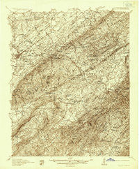
~ Tellico TN topo map, 1:48000 scale, 15 X 15 Minute, Historical, 1935
Tellico, Tennessee, USGS topographic map dated 1935.
Includes geographic coordinates (latitude and longitude). This topographic map is suitable for hiking, camping, and exploring, or framing it as a wall map.
Printed on-demand using high resolution imagery, on heavy weight and acid free paper, or alternatively on a variety of synthetic materials.
Topos available on paper, Waterproof, Poly, or Tyvek. Usually shipping rolled, unless combined with other folded maps in one order.
- Product Number: USGS-5659488
- Free digital map download (high-resolution, GeoPDF): Tellico, Tennessee (file size: 16 MB)
- Map Size: please refer to the dimensions of the GeoPDF map above
- Weight (paper map): ca. 55 grams
- Map Type: POD USGS Topographic Map
- Map Series: HTMC
- Map Verison: Historical
- Cell ID: 63437
- Scan ID: 155925
- Survey Year: 1935
- Datum: NAD27
- Map Projection: Polyconic
- Advance: Yes
- Map published by United States Geological Survey
- Keywords: Nonstandard Press Run; Overedge
- Map Language: English
- Scanner Resolution: 600 dpi
- Map Cell Name: Tellico
- Grid size: 15 X 15 Minute
- Date on map: 1935
- Map Scale: 1:48000
- Geographical region: Tennessee, United States
Neighboring Maps:
All neighboring USGS topo maps are available for sale online at a variety of scales.
Spatial coverage:
Topo map Tellico, Tennessee, covers the geographical area associated the following places:
- Jacktown - Towee Falls (historical) - Liberty Hill - Holly Springs - Smithfield - Bethlehem - Mecca - Gudger - Old Englewood - Big Creek - Conasauga - Macedonia - Sandy Lane - Jalapa - Notchy Creek - Rocky Spring - Ebenezer - Belltown - Tellico Beach - Rural Vale - Nonaburg - Belltown Mill - Chestuee - Sink (historical) - Epperson - Arden - Bullet Creek - Conasauga Mill - Tevis - Burger - Ivy - Manila - Stakely Mill - Englewood - Prospect - Coker Creek - Mount Harmony - Mount Vernon - Tellico Plains - Ellis Mill - Ho (historical)
- Map Area ID: AREA35.535.25-84.5-84.25
- Northwest corner Lat/Long code: USGSNW35.5-84.5
- Northeast corner Lat/Long code: USGSNE35.5-84.25
- Southwest corner Lat/Long code: USGSSW35.25-84.5
- Southeast corner Lat/Long code: USGSSE35.25-84.25
- Northern map edge Latitude: 35.5
- Southern map edge Latitude: 35.25
- Western map edge Longitude: -84.5
- Eastern map edge Longitude: -84.25


