
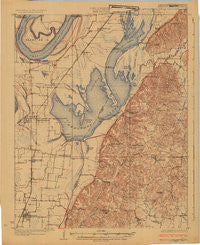
~ Reelfoot Lake TN topo map, 1:62500 scale, 15 X 15 Minute, Historical, 1925
Reelfoot Lake, Tennessee, USGS topographic map dated 1925.
Includes geographic coordinates (latitude and longitude). This topographic map is suitable for hiking, camping, and exploring, or framing it as a wall map.
Printed on-demand using high resolution imagery, on heavy weight and acid free paper, or alternatively on a variety of synthetic materials.
Topos available on paper, Waterproof, Poly, or Tyvek. Usually shipping rolled, unless combined with other folded maps in one order.
- Product Number: USGS-5659484
- Free digital map download (high-resolution, GeoPDF): Reelfoot Lake, Tennessee (file size: 6 MB)
- Map Size: please refer to the dimensions of the GeoPDF map above
- Weight (paper map): ca. 55 grams
- Map Type: POD USGS Topographic Map
- Map Series: HTMC
- Map Verison: Historical
- Cell ID: 61538
- Scan ID: 514843
- Visual Version Number: 2
- Survey Year: 1923
- Datum: NAD
- Map Projection: Polyconic
- Map published by United States Geological Survey
- Keywords: Overedge
- Map Language: English
- Scanner Resolution: 508 dpi
- Map Cell Name: Reelfoot Lake
- Grid size: 15 X 15 Minute
- Date on map: 1925
- Map Scale: 1:62500
- Geographical region: Tennessee, United States
Neighboring Maps:
All neighboring USGS topo maps are available for sale online at a variety of scales.
Spatial coverage:
Topo map Reelfoot Lake, Tennessee, covers the geographical area associated the following places:
- Estes Pond - Walnut Log - Glass - Haynes - Roneys Store - Tiptonville - Hornbeak - Spout Springs - Proctor City - Bethel (historical) - Blue Bank - Lake Drive - Lassiter Corner - Phillippy - Samburg - Ridgely - New Markham - Minnick - Owl City - Cronanville - Gratio - Sunkist Beach - Wynnburg - Edgewater Beach - Madie - Bessie - Wright - Grays Camp - Keefe - Cates - Magnolia Beach - Jacksonville - Elbridge - Webb Chapel
- Map Area ID: AREA36.536.25-89.5-89.25
- Northwest corner Lat/Long code: USGSNW36.5-89.5
- Northeast corner Lat/Long code: USGSNE36.5-89.25
- Southwest corner Lat/Long code: USGSSW36.25-89.5
- Southeast corner Lat/Long code: USGSSE36.25-89.25
- Northern map edge Latitude: 36.5
- Southern map edge Latitude: 36.25
- Western map edge Longitude: -89.5
- Eastern map edge Longitude: -89.25


