
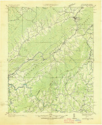
~ Doe Mountain TN topo map, 1:48000 scale, 15 X 15 Minute, Historical, 1935
Doe Mountain, Tennessee, USGS topographic map dated 1935.
Includes geographic coordinates (latitude and longitude). This topographic map is suitable for hiking, camping, and exploring, or framing it as a wall map.
Printed on-demand using high resolution imagery, on heavy weight and acid free paper, or alternatively on a variety of synthetic materials.
Topos available on paper, Waterproof, Poly, or Tyvek. Usually shipping rolled, unless combined with other folded maps in one order.
- Product Number: USGS-5374336
- Free digital map download (high-resolution, GeoPDF): Doe Mountain, Tennessee (file size: 9 MB)
- Map Size: please refer to the dimensions of the GeoPDF map above
- Weight (paper map): ca. 55 grams
- Map Type: POD USGS Topographic Map
- Map Series: HTMC
- Map Verison: Historical
- Cell ID: 53479
- Scan ID: 162411
- Woodland Tint: Yes
- Visual Version Number: 1
- Field Check Year: 1935
- Datum: NAD27
- Map Projection: Polyconic
- Advance: Yes
- Planimetric: Yes
- Map published by United States Geological Survey
- Map published by Tennessee Valley Authority
- Map Language: English
- Scanner Resolution: 600 dpi
- Map Cell Name: Doc Mountain
- Grid size: 15 X 15 Minute
- Date on map: 1935
- Map Scale: 1:48000
- Geographical region: Tennessee, United States
Neighboring Maps:
All neighboring USGS topo maps are available for sale online at a variety of scales.
Spatial coverage:
Topo map Doe Mountain, Tennessee, covers the geographical area associated the following places:
- Buntontown - Red Tail Mountain - Amantha - Pandora - Sweetwater - Vaughtsville (historical) - Farthing (historical) - Shouns - Mount Gilead - Peoria - Ironville (historical) - Norris - Doeville - Neva - Mabel - Flat Springs - Mountain City - Beech Creek - Watauga Falls (historical) - Forest Grove - Midway - Casper (historical) - Sandy - Center View - Little Doe - Reese - Damascus - Mill Creek - Sherwood - Bethel - Leander - Stump Knob (historical) - Eastman (historical) - Dry Hill - Elk Mills - Silverstone - Sugar Grove - Maymead - Walnut Grove - North Fork - Cowanstown (historical) - Crackers Neck - Holy Hill - Heath
- Map Area ID: AREA36.536.25-82-81.75
- Northwest corner Lat/Long code: USGSNW36.5-82
- Northeast corner Lat/Long code: USGSNE36.5-81.75
- Southwest corner Lat/Long code: USGSSW36.25-82
- Southeast corner Lat/Long code: USGSSE36.25-81.75
- Northern map edge Latitude: 36.5
- Southern map edge Latitude: 36.25
- Western map edge Longitude: -82
- Eastern map edge Longitude: -81.75


