
~ Johnson City TN topo map, 1:250000 scale, 1 X 2 Degree, Historical, 1963
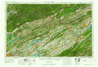
Johnson City, Tennessee, USGS topographic map dated 1963.
Includes geographic coordinates (latitude and longitude). This topographic map is suitable for hiking, camping, and exploring, or framing it as a wall map.
Printed on-demand using high resolution imagery, on heavy weight and acid free paper, or alternatively on a variety of synthetic materials.
Topos available on paper, Waterproof, Poly, or Tyvek. Usually shipping rolled, unless combined with other folded maps in one order.
- Product Number: USGS-5339224
- Free digital map download (high-resolution, GeoPDF): Johnson City, Tennessee (file size: 23 MB)
- Map Size: please refer to the dimensions of the GeoPDF map above
- Weight (paper map): ca. 55 grams
- Map Type: POD USGS Topographic Map
- Map Series: HTMC
- Map Verison: Historical
- Cell ID: 68844
- Scan ID: 148011
- Woodland Tint: Yes
- Field Check Year: 1957
- Datum: Unstated
- Map Projection: Transverse Mercator
- Map published by United States Army Corps of Engineers
- Map published by United States Army
- Map Language: English
- Scanner Resolution: 600 dpi
- Map Cell Name: Johnson City
- Grid size: 1 X 2 Degree
- Date on map: 1963
- Map Scale: 1:250000
- Geographical region: Tennessee, United States
Neighboring Maps:
All neighboring USGS topo maps are available for sale online at a variety of scales.
Spatial coverage:
Topo map Johnson City, Tennessee, covers the geographical area associated the following places:
- Apple Grove (historical) - Needmore - Oakland - Graveston - Duke (historical) - Chestnut Grove - Three Forks - Old Cedar Fork - Vicco - Huntington Hills - Lost Cove - Warrensburg - Grays Ford - Kingsley Hills - South Gate Village - Shelleys - Silver City - Ridgeview Mobile Home Park - Meadowview - Indian HIlls - Purcell - Powells River (historical) - Green Acres - Henegartown - Scoot Mill - Red Hill - Duo - Mendota - Tin Can Alley (historical) - Lewis Creek - Marshall - Gilmer Park - Westwood-Gray Subdivision - Mason Springs - Lee Valley - Riverview - Goin - Cloud Creek - Brookmead - Ernestville - Field - Marguerite - East Pineville - Big Barren - Maytown - Turley Mills (historical) - Sunset Hills - Bloomington Heights - Stonega - Tumbez - Haynesfield - Fieldview - Wallace - Emanuel - Mayday - Little Barren - Bardo - Huntingdon Place - Pruden - Caney Valley - Bumpus Cove - Natural Tunnel - Thorn Grove - Kimbrough Crossroad - Chuckey - Herald - Bemberg - Grandview - Coulter - February - Withers - Pine Grove - Temple Acres - Gap Run - Wilson Hill - Kentucky Heights - Rexford (historical) - Massengill Mill - Chevrolet - Peterson - Briarwood Estates - Haynes (historical) - Cox Place - Welch Crossroad - Saylor - Oakview - Briarwood - Grigbys Store - Warbranch - Stephens - Ducktown - Westivew Woods - Gibson Station - Maynardville - Whitson - Camp Creek - Gibson Hall - Counts - Tusculum Place - Shields
- Map Area ID: AREA3736-84-82
- Northwest corner Lat/Long code: USGSNW37-84
- Northeast corner Lat/Long code: USGSNE37-82
- Southwest corner Lat/Long code: USGSSW36-84
- Southeast corner Lat/Long code: USGSSE36-82
- Northern map edge Latitude: 37
- Southern map edge Latitude: 36
- Western map edge Longitude: -84
- Eastern map edge Longitude: -82


