
~ Johnson City TN topo map, 1:250000 scale, 1 X 2 Degree, Historical, 1957, updated 1966
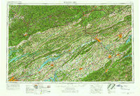
Johnson City, Tennessee, USGS topographic map dated 1957.
Includes geographic coordinates (latitude and longitude). This topographic map is suitable for hiking, camping, and exploring, or framing it as a wall map.
Printed on-demand using high resolution imagery, on heavy weight and acid free paper, or alternatively on a variety of synthetic materials.
Topos available on paper, Waterproof, Poly, or Tyvek. Usually shipping rolled, unless combined with other folded maps in one order.
- Product Number: USGS-5339220
- Free digital map download (high-resolution, GeoPDF): Johnson City, Tennessee (file size: 23 MB)
- Map Size: please refer to the dimensions of the GeoPDF map above
- Weight (paper map): ca. 55 grams
- Map Type: POD USGS Topographic Map
- Map Series: HTMC
- Map Verison: Historical
- Cell ID: 68844
- Scan ID: 148009
- Imprint Year: 1966
- Woodland Tint: Yes
- Edit Year: 1966
- Field Check Year: 1957
- Datum: Unstated
- Map Projection: Transverse Mercator
- Map published by United States Army Corps of Engineers
- Map published by United States Army
- Map Language: English
- Scanner Resolution: 600 dpi
- Map Cell Name: Johnson City
- Grid size: 1 X 2 Degree
- Date on map: 1957
- Map Scale: 1:250000
- Geographical region: Tennessee, United States
Neighboring Maps:
All neighboring USGS topo maps are available for sale online at a variety of scales.
Spatial coverage:
Topo map Johnson City, Tennessee, covers the geographical area associated the following places:
- Locust Mount - Oakland Gardens - Ely - Varilla - Zenobia - Roan Hill - Livesay Mill - Willow Springs - Castell Springs - College View - Kilgore Subdivision - Valley Hills - Hampton Mill - Bunker Hill - Rose Hill - Cannon - Lake Forest Estates - Henshaw (historical) - East Village - Skinner Crossroad - Glendale - Hacker (historical) - Fairview - Coldiron - Wood Acres - Crouch Crossroad - Idol - Opossum (historical) - Dogwood Hills - Westview - Castlewood - Baxter - Verdi - Hossan Heights - Princeton Hills - Loafers Glory - Beech Grove - Nanatlugunyi (historical) - Flat Lick - Sequoyah Heights - Crosby - Galbraith - Roan Mountain - Nickelsville - Nash Mill - Phebe (historical) - Butcher (historical) - Sherwood Estates - Kidwell - Hamilton - Liberty Hill - Highsplint - Long Island - Cuba - Lone Star - Carfax - Mayo (historical) - Bonny Blue - Sunnybrook Number Two - Riverview - Rock City - Holston Hills - Clinchport - Flat Hollow - Holston (historical) - Tin Can Alley (historical) - Horse Creek - Pine Hills - Beverly - Speedwell - Condon - Kingswood - Clinchview Heights - Caney Valley - Molus - Lawson Mill - Rural - Davis Bend (historical) - Buffalo Springs - Upper Laurel Fork (historical) - Burtons Ford - Emmett - Hopewell - Bethlehem - Sampson - Fisher Creek - Holttown - Candler - Cracker Neck - West Hills - Baughman - Craft Mill - Redstone - Christian Bend - River Hill - Hyatt Acres - Alpha - Braemar - Manring - Haynes (historical)
- Map Area ID: AREA3736-84-82
- Northwest corner Lat/Long code: USGSNW37-84
- Northeast corner Lat/Long code: USGSNE37-82
- Southwest corner Lat/Long code: USGSSW36-84
- Southeast corner Lat/Long code: USGSSE36-82
- Northern map edge Latitude: 37
- Southern map edge Latitude: 36
- Western map edge Longitude: -84
- Eastern map edge Longitude: -82


