
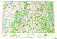
~ Dyersburg TN topo map, 1:250000 scale, 1 X 2 Degree, Historical, 1956, updated 1966
Dyersburg, Tennessee, USGS topographic map dated 1956.
Includes geographic coordinates (latitude and longitude). This topographic map is suitable for hiking, camping, and exploring, or framing it as a wall map.
Printed on-demand using high resolution imagery, on heavy weight and acid free paper, or alternatively on a variety of synthetic materials.
Topos available on paper, Waterproof, Poly, or Tyvek. Usually shipping rolled, unless combined with other folded maps in one order.
- Product Number: USGS-5339212
- Free digital map download (high-resolution, GeoPDF): Dyersburg, Tennessee (file size: 15 MB)
- Map Size: please refer to the dimensions of the GeoPDF map above
- Weight (paper map): ca. 55 grams
- Map Type: POD USGS Topographic Map
- Map Series: HTMC
- Map Verison: Historical
- Cell ID: 68760
- Scan ID: 148005
- Imprint Year: 1966
- Woodland Tint: Yes
- Edit Year: 1964
- Field Check Year: 1956
- Datum: Unstated
- Map Projection: Transverse Mercator
- Map published by United States Army Corps of Engineers
- Map published by United States Army
- Map Language: English
- Scanner Resolution: 600 dpi
- Map Cell Name: Dyersburg
- Grid size: 1 X 2 Degree
- Date on map: 1956
- Map Scale: 1:250000
- Geographical region: Tennessee, United States
Neighboring Maps:
All neighboring USGS topo maps are available for sale online at a variety of scales.
Spatial coverage:
Topo map Dyersburg, Tennessee, covers the geographical area associated the following places:
- Buchanan - Lake Drive - Moffatt - Fairdealing - Hailwell - New Hope - Templeton - Broadwater - Micola - Laneview - Fremont - Tyler - Scotts Corner - Hayti - Backusburg - Morris Valley (historical) - Minnick - Milburn - Liberty - Kewanee - Dogtown - Kirbyton - Clinton - Crossland - Gleason - New Zion - Mengelwood - Magnolia Beach - Kansas - Bugg - Liberty (historical) - Sedalia - Bell City - Melber - Bragg City - Woods (historical) - Pulltight - Gibson - Bradleytown - Malden - Dexter - Hills Store - Browns Grove - Wurth - Emmaus (historical) - Sikeston - Lynn Grove - Birmingham - Mount Herman - Lowes - South Murray - Lynnville - Freeland - Wingo - Camden - Folsomdale - Hardin - Mackeys - Ingram Ridge - Russell Chapel (historical) - Red Hill - Cloverdale - Ferguson Spring - Sugar Creek (historical) - North Wardell - Elbridge - Vaughns Grove - Bryans Ford - Austin Springs - Deventer - Black Center - Lovelaceville - Shade - Palma - Matthews - Steeleville (historical) - Circle City - LaValle - Walnut Grove - Charleston - Clayton - Otis - Englewood - Woodall (historical) - Grayridge - Kimery - Almo Heights - Como - Chickasaw Heights - Crossroads - Jarrell - Wyatt - Anna Lynne - Yancy Darnell (historical) - Holland - Noxall - Farrenburg - Bethlehem - Griggstown (historical) - Turner
- Map Area ID: AREA3736-90-88
- Northwest corner Lat/Long code: USGSNW37-90
- Northeast corner Lat/Long code: USGSNE37-88
- Southwest corner Lat/Long code: USGSSW36-90
- Southeast corner Lat/Long code: USGSSE36-88
- Northern map edge Latitude: 37
- Southern map edge Latitude: 36
- Western map edge Longitude: -90
- Eastern map edge Longitude: -88


