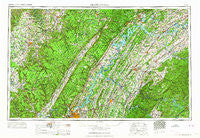
~ Chattanooga TN topo map, 1:250000 scale, 1 X 2 Degree, Historical, 1964
Chattanooga, Tennessee, USGS topographic map dated 1964.
Includes geographic coordinates (latitude and longitude). This topographic map is suitable for hiking, camping, and exploring, or framing it as a wall map.
Printed on-demand using high resolution imagery, on heavy weight and acid free paper, or alternatively on a variety of synthetic materials.
Topos available on paper, Waterproof, Poly, or Tyvek. Usually shipping rolled, unless combined with other folded maps in one order.
- Product Number: USGS-5339190
- Free digital map download (high-resolution, GeoPDF): Chattanooga, Tennessee (file size: 21 MB)
- Map Size: please refer to the dimensions of the GeoPDF map above
- Weight (paper map): ca. 55 grams
- Map Type: POD USGS Topographic Map
- Map Series: HTMC
- Map Verison: Historical
- Cell ID: 72221
- Scan ID: 148897
- Woodland Tint: Yes
- Field Check Year: 1957
- Datum: Unstated
- Map Projection: Transverse Mercator
- Map published by United States Geological Survey
- Map Language: English
- Scanner Resolution: 600 dpi
- Map Cell Name: Chattanooga
- Grid size: 1 X 2 Degree
- Date on map: 1964
- Map Scale: 1:250000
- Geographical region: Tennessee, United States
Neighboring Maps:
All neighboring USGS topo maps are available for sale online at a variety of scales.
Spatial coverage:
Topo map Chattanooga, Tennessee, covers the geographical area associated the following places:
- Smoke Rise - Mount Ararat - Lantana - Vancouver (historical) - Apollo Shores - Hopewell Springs - Kiser - Selkirk (historical) - Brentwood - Washington Hills - Graysville - Holiday Hills - Beta - Bratchers Crossroads - Midway - Harrison Bluff - Ela Wada Terrace - Castaway Cove - Dunlap - Cloverdale Estates - Lovell Road Mobile Home Park - Trails West - Hillsboro - Hickman Subdivision - Haleys Grove - Providence - Holiday Shores - Jones Mobile Home Park - Decatur Hills - Pinhook - Armona - Fourmile Bridge (historical) - Harbor Heights - North Liberty - Acme Mill - Timberwick - Blanton (historical) - Cave Creek - Vests - Wetmore - Farrington Forest - Antioch - Keltonburg - Maplewood Heights - Sequoyah Shores - Burlington Heights - Blair - Fanchers Mills - Riggs Trailer Park - Stewart Chapel - Gulfwood - Savannah Peninsula - Hobbs Hill - Harriman - Flat Branch - Lone Oak - East Sweetwater - Benton Springs - Camp Jordan - Meade (historical) - Berea - Elder Mountain - Ten Mile - Coleman Subdivision - Pisgah - Lakeland Subdivision - Town Branch Estates - Bayside - Folger (historical) - Creekwood Terrace - Coytee (historical) - Saratoga Springs - Oak Grove - Dogwood - Bluewing - Sunnyside - Claxton - Old Zion - Brashears Subdivision - Perilla (historical) - Suburban Shores - Luminary - Balltown - Howardville - Schoolfield (historical) - Watts Bar Estates - Midvale - Hiawassee - Boiling Springs - Royal Oak - Lucky - Towne Hills - Logan Heights - Center Point - Nonaburg - Hidden Valley - Hillcrest - Hothouse - Dallas Gardens - Miser Station
- Map Area ID: AREA3635-86-84
- Northwest corner Lat/Long code: USGSNW36-86
- Northeast corner Lat/Long code: USGSNE36-84
- Southwest corner Lat/Long code: USGSSW35-86
- Southeast corner Lat/Long code: USGSSE35-84
- Northern map edge Latitude: 36
- Southern map edge Latitude: 35
- Western map edge Longitude: -86
- Eastern map edge Longitude: -84

