
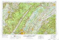
~ Chattanooga TN topo map, 1:250000 scale, 1 X 2 Degree, Historical, 1957, updated 1976
Chattanooga, Tennessee, USGS topographic map dated 1957.
Includes geographic coordinates (latitude and longitude). This topographic map is suitable for hiking, camping, and exploring, or framing it as a wall map.
Printed on-demand using high resolution imagery, on heavy weight and acid free paper, or alternatively on a variety of synthetic materials.
Topos available on paper, Waterproof, Poly, or Tyvek. Usually shipping rolled, unless combined with other folded maps in one order.
- Product Number: USGS-5339186
- Free digital map download (high-resolution, GeoPDF): Chattanooga, Tennessee (file size: 22 MB)
- Map Size: please refer to the dimensions of the GeoPDF map above
- Weight (paper map): ca. 55 grams
- Map Type: POD USGS Topographic Map
- Map Series: HTMC
- Map Verison: Historical
- Cell ID: 72221
- Scan ID: 148895
- Imprint Year: 1976
- Woodland Tint: Yes
- Photo Revision Year: 1972
- Aerial Photo Year: 1972
- Edit Year: 1972
- Field Check Year: 1957
- Datum: Unstated
- Map Projection: Transverse Mercator
- Map published by United States Geological Survey
- Map Language: English
- Scanner Resolution: 600 dpi
- Map Cell Name: Chattanooga
- Grid size: 1 X 2 Degree
- Date on map: 1957
- Map Scale: 1:250000
- Geographical region: Tennessee, United States
Neighboring Maps:
All neighboring USGS topo maps are available for sale online at a variety of scales.
Spatial coverage:
Topo map Chattanooga, Tennessee, covers the geographical area associated the following places:
- Philippi - Tan Rara Oesta - Forestdale - Bear Branch (historical) - Trigonia - Duncan Hills - West End - Gath - Kingston - Murray Store - Pine Springs - Camp Jordan - Ebenezer - Mineral Springs - Apison - Hickory Woods - Bushtown - Walnut Grove - Tranquillity - Brayton - Suck Creek - Coletown - Countryside Village - Bradbury - Caramel Village - Galaxy Heights - Edgewater Estates - Trails West - Greentown - Highland Forest - Alto - Dunlap - Meadowview - Huntsville - Kings Point - Westview Heights - Seminole Subdivision - Conasauga - Howard Springs - Sugar Grove - Lakeshor Manor - Ponderosa - Hambright - Ridgedale - Orchard View - Farrington Forest - Signal Mountain - Cute (historical) - Hidden Hills Estates - Huntingdon Forest - Fairview Acres - New Hope - Parkview - Young (historical) - Grady - Montague - Deerwood Forest - Clover Hill - Timberwick - Rolling Hills - Crisp Spring - Harbuck - New Harmony - Balta - Woodland Trace - Rural Vale - White City - Briarfield - Westavia Woods - Pine Hills - Heritage Park - Long Branch - Center Hill - Piney Grove - Toqua - Auburn Hills - Goodsprings - Darkey Springs - Capital Heights - McElroy - Belk - Claxton - Summerfield - Midtown Heights - Camelot - Gulfwood - Brashears Subdivision - Calico - Elkhead - Pioneer Village - Hiawassee - Waucheesi - Orchard Valley Estates - Kensington - Pleasant Hills - Bartlebaugh - Scenic Point Estates - Farner - Camelot - Fountain Grove
- Map Area ID: AREA3635-86-84
- Northwest corner Lat/Long code: USGSNW36-86
- Northeast corner Lat/Long code: USGSNE36-84
- Southwest corner Lat/Long code: USGSSW35-86
- Southeast corner Lat/Long code: USGSSE35-84
- Northern map edge Latitude: 36
- Southern map edge Latitude: 35
- Western map edge Longitude: -86
- Eastern map edge Longitude: -84


