
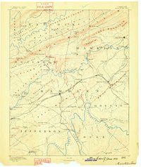
~ Morristown TN topo map, 1:125000 scale, 30 X 30 Minute, Historical, 1883
Morristown, Tennessee, USGS topographic map dated 1883.
Includes geographic coordinates (latitude and longitude). This topographic map is suitable for hiking, camping, and exploring, or framing it as a wall map.
Printed on-demand using high resolution imagery, on heavy weight and acid free paper, or alternatively on a variety of synthetic materials.
Topos available on paper, Waterproof, Poly, or Tyvek. Usually shipping rolled, unless combined with other folded maps in one order.
- Product Number: USGS-5339056
- Free digital map download (high-resolution, GeoPDF): Morristown, Tennessee (file size: 6 MB)
- Map Size: please refer to the dimensions of the GeoPDF map above
- Weight (paper map): ca. 55 grams
- Map Type: POD USGS Topographic Map
- Map Series: HTMC
- Map Verison: Historical
- Cell ID: 66097
- Scan ID: 153457
- Survey Year: 1883
- Datum: Unstated
- Map Projection: Unstated
- Map published by United States Geological Survey
- Map Language: English
- Scanner Resolution: 600 dpi
- Map Cell Name: Morristown
- Grid size: 30 X 30 Minute
- Date on map: 1883
- Map Scale: 1:125000
- Geographical region: Tennessee, United States
Neighboring Maps:
All neighboring USGS topo maps are available for sale online at a variety of scales.
Spatial coverage:
Topo map Morristown, Tennessee, covers the geographical area associated the following places:
- Mount Horeb - Mary Chapel - Bray - Otes - Barton Springs - East Ridge - Rushy Springs - Ritchie - Meadow Branch - Lake Forest Estates - Oak Grove - West Lake Estates - Beaver Dam (historical) - Pate Hill - Greenhill - Liberty Heights - High Point - Ridgewood - Friendship - Hopper Bluff - Briar Thicket - Emerald Acres - Oakland - Navaho Hills - Buell Acres - Sequooyah Estates - Cain Mill - Clinchview Heights - Timbercrest - Bright (historical) - Hurley Acres - Hyatt Acres - Mulberry Acres - Crockett Ridge - Sherwood Estates - Monte Vista Estates - Wyatt Village - Bulls Gap - Rankin - Yount Town - Jaybird - Dandridge - Wildwood - West Hills - Camelot - Holttown - Dalton Heights - Union Heights - Carter Acres - Woodcrest Hills - Morristown - Belair - Landmark Estates - Idol - Leadvale - Whitesburg - Briarcliff View - Rolling Hills - Salem - Papaw - Riverview - The Meadows - Leadvale - Thula - Countryside Mobile Home Park - Jefferson City - Green Acres - Echo Hills - Indian HIlls - Rock Haven - Cuba - Pleasant view - Drinnon Heights - Ottinger - Shiloh - Warrensburg - Lakewood Estates - Mountain View - Kathy Hills - Fernwood - Mansfield Gap - Russellville - Wilderness Shores - Southern Heights - Baneberry - The Colonies - Prima Estates - Hales Crossroads - Shiloh - Beacon Hills - Xenophon - Smokerise - Dover - Crosby - Parrottsville - Caney Valley - Mooresburg - Bowen - Skinner Crossroad - Purkey Estates
- Map Area ID: AREA36.536-83.5-83
- Northwest corner Lat/Long code: USGSNW36.5-83.5
- Northeast corner Lat/Long code: USGSNE36.5-83
- Southwest corner Lat/Long code: USGSSW36-83.5
- Southeast corner Lat/Long code: USGSSE36-83
- Northern map edge Latitude: 36.5
- Southern map edge Latitude: 36
- Western map edge Longitude: -83.5
- Eastern map edge Longitude: -83


