
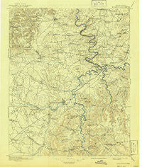
~ Mc Minnville TN topo map, 1:125000 scale, 30 X 30 Minute, Historical, 1895, updated 1941
Mc Minnville, Tennessee, USGS topographic map dated 1895.
Includes geographic coordinates (latitude and longitude). This topographic map is suitable for hiking, camping, and exploring, or framing it as a wall map.
Printed on-demand using high resolution imagery, on heavy weight and acid free paper, or alternatively on a variety of synthetic materials.
Topos available on paper, Waterproof, Poly, or Tyvek. Usually shipping rolled, unless combined with other folded maps in one order.
- Product Number: USGS-5339042
- Free digital map download (high-resolution, GeoPDF): Mc Minnville, Tennessee (file size: 7 MB)
- Map Size: please refer to the dimensions of the GeoPDF map above
- Weight (paper map): ca. 55 grams
- Map Type: POD USGS Topographic Map
- Map Series: HTMC
- Map Verison: Historical
- Cell ID: 66022
- Scan ID: 150196
- Imprint Year: 1941
- Survey Year: 1891
- Datum: Unstated
- Map Projection: Polyconic
- Map published by United States Geological Survey
- Map Language: English
- Scanner Resolution: 600 dpi
- Map Cell Name: McMinnville
- Grid size: 30 X 30 Minute
- Date on map: 1895
- Map Scale: 1:125000
- Geographical region: Tennessee, United States
Neighboring Maps:
All neighboring USGS topo maps are available for sale online at a variety of scales.
Spatial coverage:
Topo map Mc Minnville, Tennessee, covers the geographical area associated the following places:
- Old Zion - McMinnville - Caneridge (historical) - McElroy - Berea - Haleville (historical) - Woods - Peeled Chestnut - Mount Zion - Daylight - Mount Ararat - Fountain Grove - Morrison - Yager - Groves (historical) - Evanston (historical) - Cambridge - Gath - Smyrna - Vervilla - Sugar Tree Knob - New (historical) - Bates Hill - Irving College - Drop (historical) - Summitville Trailer Park - Philippi - Bethel - Half Acre - Womack - Shady Grove - Viola - Gum Spring - Centertown - Quebeck - Sainville - Sligo (historical) - Jessie - Blue Hill - Shellsford - Pisgah - Sopha (historical) - Jefferson - Stewart Chapel - Belk - Oliveville (historical) - Blanton (historical) - Watkins - Flatwood - Blue Springs - Rabbit Bluff (historical) - Laurel Cove (historical) - Harmony - Laurelburg - Doyle - Johnsons Chapel - Summitville - Oakland - Mount Olive - Dawn (historical) - Leoni - Hiawassee - Dibrell - Hillis (historical) - Welchland - Fairview - Joppa - Catlen - Lucky - Bratchers Crossroads - Pinhook (historical) - Horseshoe Falls (historical) - Lawson Mill - Rock Island - Antioch - Cross Roads - Fanchers Mills - Earleyville - Bluff Springs - Crisp Spring - Green Hill - White Hill - Hanlan (historical) - Goodbars - Darkey Springs - Shady Grove - Bear Branch (historical) - Gassaway - Clearmont - Curtistown - Fall City - Old Well Crossing - Laurel Creek - Nicholson Springs (historical) - Harrican (historical) - Cedar Grove - Cassville - Thomas Town (historical) - Rowland - Mount Sterling (historical)
- Map Area ID: AREA3635.5-86-85.5
- Northwest corner Lat/Long code: USGSNW36-86
- Northeast corner Lat/Long code: USGSNE36-85.5
- Southwest corner Lat/Long code: USGSSW35.5-86
- Southeast corner Lat/Long code: USGSSE35.5-85.5
- Northern map edge Latitude: 36
- Southern map edge Latitude: 35.5
- Western map edge Longitude: -86
- Eastern map edge Longitude: -85.5


