
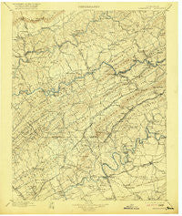
~ Maynardville TN topo map, 1:125000 scale, 30 X 30 Minute, Historical, 1900, updated 1921
Maynardville, Tennessee, USGS topographic map dated 1900.
Includes geographic coordinates (latitude and longitude). This topographic map is suitable for hiking, camping, and exploring, or framing it as a wall map.
Printed on-demand using high resolution imagery, on heavy weight and acid free paper, or alternatively on a variety of synthetic materials.
Topos available on paper, Waterproof, Poly, or Tyvek. Usually shipping rolled, unless combined with other folded maps in one order.
- Product Number: USGS-5339040
- Free digital map download (high-resolution, GeoPDF): Maynardville, Tennessee (file size: 8 MB)
- Map Size: please refer to the dimensions of the GeoPDF map above
- Weight (paper map): ca. 55 grams
- Map Type: POD USGS Topographic Map
- Map Series: HTMC
- Map Verison: Historical
- Cell ID: 66011
- Scan ID: 153525
- Imprint Year: 1921
- Survey Year: 1895
- Datum: Unstated
- Map Projection: Unstated
- Map published by United States Geological Survey
- Map Language: English
- Scanner Resolution: 600 dpi
- Map Cell Name: Maynardville
- Grid size: 30 X 30 Minute
- Date on map: 1900
- Map Scale: 1:125000
- Geographical region: Tennessee, United States
Neighboring Maps:
All neighboring USGS topo maps are available for sale online at a variety of scales.
Spatial coverage:
Topo map Maynardville, Tennessee, covers the geographical area associated the following places:
- Corinth - Hammer Store - Washburn - Millertown - Tampico - Halls And Powell Mobile Home Park - Highpoint (historical) - Ashby (historical) - Ridgeview Mobile Home Park - Tillery Drive Mobile Home Park - Stokes Mill - Oak Grove - Highlands (historical) - Timber Line Estates - Irwin - Halls - Chilhowee Hills - Little Barren - Pinewood Trailer Park - Harrill Hills - Blueberry Hills - Greenway - Emory Estates - Speedwell - Lulaville - Chestnut Grove - Preston (historical) - Union - Sunset - Rutledge - Wyricktown - Maples (historical) - Northbrook - Carter - Stockville (historical) - Mill Spring - Mayo (historical) - Lost Creek (historical) - McMillan - Dry Gap - Freeway - Powder Springs - Pinhook - Shipetown - Hinds Creek Valley - Oak Park - Fults Trailer Park - Old Cedar Fork - Graveston - Lily Grove - Rocky Valley - Alder - Williams Mill - Oak Grove - Woodburn (historical) - Ridenour - North Knoxville - Tazewell - Lickskillet - Duke (historical) - Hodges - Mossy Spring - Loyston (historical) - Hurst Mill - Three Points - Beech Grove - Corryton - Black Oak - Clinch River (historical) - Chesney - Lone Mountain - Cupp Mill - Buffat Heights - Brookfield Acres - Alder Springs - Alena (historical) - Little Barren - Friends Station - Duo - Northridge Estates - Collins Mill - Springdale - Elm Springs - Luttrell - Briarwood Estates - Sunrise - Navehill - Girlton (historical) - Acuff - Beulah - House Mountain (historical) - Ambro (historical) - Maynardville - Haynes (historical) - Bald Hill (historical) - Wooddale - Cedar Crest North - Welch Crossroad - Arlington - Ritta
- Map Area ID: AREA36.536-84-83.5
- Northwest corner Lat/Long code: USGSNW36.5-84
- Northeast corner Lat/Long code: USGSNE36.5-83.5
- Southwest corner Lat/Long code: USGSSW36-84
- Southeast corner Lat/Long code: USGSSE36-83.5
- Northern map edge Latitude: 36.5
- Southern map edge Latitude: 36
- Western map edge Longitude: -84
- Eastern map edge Longitude: -83.5


