
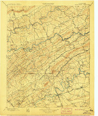
~ Maynardville TN topo map, 1:125000 scale, 30 X 30 Minute, Historical, 1900, updated 1907
Maynardville, Tennessee, USGS topographic map dated 1900.
Includes geographic coordinates (latitude and longitude). This topographic map is suitable for hiking, camping, and exploring, or framing it as a wall map.
Printed on-demand using high resolution imagery, on heavy weight and acid free paper, or alternatively on a variety of synthetic materials.
Topos available on paper, Waterproof, Poly, or Tyvek. Usually shipping rolled, unless combined with other folded maps in one order.
- Product Number: USGS-5339038
- Free digital map download (high-resolution, GeoPDF): Maynardville, Tennessee (file size: 8 MB)
- Map Size: please refer to the dimensions of the GeoPDF map above
- Weight (paper map): ca. 55 grams
- Map Type: POD USGS Topographic Map
- Map Series: HTMC
- Map Verison: Historical
- Cell ID: 66011
- Scan ID: 153524
- Imprint Year: 1907
- Survey Year: 1895
- Datum: Unstated
- Map Projection: Unstated
- Map published by United States Geological Survey
- Map Language: English
- Scanner Resolution: 600 dpi
- Map Cell Name: Maynardville
- Grid size: 30 X 30 Minute
- Date on map: 1900
- Map Scale: 1:125000
- Geographical region: Tennessee, United States
Neighboring Maps:
All neighboring USGS topo maps are available for sale online at a variety of scales.
Spatial coverage:
Topo map Maynardville, Tennessee, covers the geographical area associated the following places:
- Cedar Grove - Fults Trailer Park - Eastwood - Murphy Mill - Sycamore Spring - Raccoon Valley - Collins Mill - Ritta - Dry Gap - Bethlehem - Lily Grove - Springdale - Carr Branch - Tillery Drive Mobile Home Park - Sunset - Perrin Hollow - Still Brook - Skaggston - Melbourne - Sharps Chapel - Dykes - Holston Mobile Home Park - Liberty Hill - Millertown - New Corinth - Braden - Alder - Puncheon Camp - Bonta Vista Estates - Highland Park - Beulah - Wyricktown - Jobe (historical) - Cedarchase - Loyston (historical) - Dumplin - Fountain City - New Market - Goin - Chestnut Ridge - Ridgeview Mobile Home Park - Old Cedar Fork - Navehill - Huntingdon Place - Rocky Valley - Chestnut Grove - Pleasant Grove - Trentville - Sentertown - Briarwood Estates - Homestead - Smithwood - Lone Mountain - Chesney - Greenwood Forest - Hallbrook - Carpenter Addition - Buffat Heights - Lickskillet - Highberry Trailer Park - Warwicktown - Rhodelia (historical) - Northridge Estates - Hodges - Condon - Fieldview - Arlington - North Hills - Sycamore (historical) - Rose Hill - Mill Spring - Welch Crossroad - Ashby (historical) - Murphy Hills - Head of Barren - Happy Acres - Brookfield Acres - Copper Ridge - Lost Creek (historical) - Mynatt - Little Barren - Villa Gardens - Thorn Grove - Emory Estates - Blaine - Russell Mill - Pedigo - Sill (historical) - House Mountain (historical) - Edmondson (historical) - Big Barren - Maloneyville - Norwood - Sunrise - Halls And Powell Mobile Home Park - Lucilla (historical) - Shipetown - Sumter Hills - Irwin - Oak Grove
- Map Area ID: AREA36.536-84-83.5
- Northwest corner Lat/Long code: USGSNW36.5-84
- Northeast corner Lat/Long code: USGSNE36.5-83.5
- Southwest corner Lat/Long code: USGSSW36-84
- Southeast corner Lat/Long code: USGSSE36-83.5
- Northern map edge Latitude: 36.5
- Southern map edge Latitude: 36
- Western map edge Longitude: -84
- Eastern map edge Longitude: -83.5


