
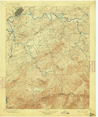
~ Knoxville TN topo map, 1:125000 scale, 30 X 30 Minute, Historical, 1901, updated 1915
Knoxville, Tennessee, USGS topographic map dated 1901.
Includes geographic coordinates (latitude and longitude). This topographic map is suitable for hiking, camping, and exploring, or framing it as a wall map.
Printed on-demand using high resolution imagery, on heavy weight and acid free paper, or alternatively on a variety of synthetic materials.
Topos available on paper, Waterproof, Poly, or Tyvek. Usually shipping rolled, unless combined with other folded maps in one order.
- Product Number: USGS-5339018
- Free digital map download (high-resolution, GeoPDF): Knoxville, Tennessee (file size: 9 MB)
- Map Size: please refer to the dimensions of the GeoPDF map above
- Weight (paper map): ca. 55 grams
- Map Type: POD USGS Topographic Map
- Map Series: HTMC
- Map Verison: Historical
- Cell ID: 320661
- Scan ID: 153511
- Imprint Year: 1915
- Survey Year: 1890
- Datum: Unstated
- Map Projection: Unstated
- Map published by United States Geological Survey
- Map Language: English
- Scanner Resolution: 600 dpi
- Map Cell Name: Knoxville
- Grid size: 30 X 30 Minute
- Date on map: 1901
- Map Scale: 1:125000
- Geographical region: Tennessee, United States
Neighboring Maps:
All neighboring USGS topo maps are available for sale online at a variety of scales.
Spatial coverage:
Topo map Knoxville, Tennessee, covers the geographical area associated the following places:
- Riverbend - Island Home - Hicks Crossing - West Maryville - Highland Acres - Hornet - Summit Hills - Rockgardens - South View Estates - Heritage Hills - Little River - Knob Creek - Peters Mill - Lincoln Park - Benford Heights Addition - Lonsdale - Hubbard - Sixmile - Mountain View Addition - Midway - Norton Creek Ranch - Blockhouse - Watertown - Oak City - Little Cove - Oakhurst - Vestal - Greenbrier - Bank (historical) - Waldens Creek - Wear Valley - Burlington - Arrowhead - Crenshaw - Bungalow - Mount Nebo (historical) - Chandler - Gibson Acres Mobile Home Park - Tee Lee Heights - Plainfield - Knoxville - Huskey Valley - Montvale - Mimosa Heights - Cherokee Hills - Asbury - Everett Heights - Lyons View - Chelsey Village - Wildwood - Topside - Forks of the River - Crossfield - Townsend - Starkeytown - Turnberry Vistas - Park Settlement - Notime (historical) - Fairview Heights - Elajay (historical) - Deep Creek - Dumplin Mill - Farrport - Dupont Springs - Line Spring - Westfields - Eagleton Village - Law Chapel - Neubert Springs - West Haven - Pleasant Hill - Seven Islands - Bassel Addition - Sequoyah Hills - Hatchertown - Amerene (historical) - Woodfield Park - Sevierville - Iris Acres - South Knoxville - Airport Plaza - Conner Heights - Doyle Springs - Lakeview Estates - Fox Hills - Tremont - Sevier Home - New Era - Calderwood - Tara Estates - McMahan - Southbrook - Harth Addition - Union Hill - Meadowood - Littlebrook - Trundle Crossroad - Pine Grove - Montvue - Bittle Heights
- Map Area ID: AREA3635.5-84-83.5
- Northwest corner Lat/Long code: USGSNW36-84
- Northeast corner Lat/Long code: USGSNE36-83.5
- Southwest corner Lat/Long code: USGSSW35.5-84
- Southeast corner Lat/Long code: USGSSE35.5-83.5
- Northern map edge Latitude: 36
- Southern map edge Latitude: 35.5
- Western map edge Longitude: -84
- Eastern map edge Longitude: -83.5


