
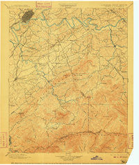
~ Knoxville TN topo map, 1:125000 scale, 30 X 30 Minute, Historical, 1901, updated 1910
Knoxville, Tennessee, USGS topographic map dated 1901.
Includes geographic coordinates (latitude and longitude). This topographic map is suitable for hiking, camping, and exploring, or framing it as a wall map.
Printed on-demand using high resolution imagery, on heavy weight and acid free paper, or alternatively on a variety of synthetic materials.
Topos available on paper, Waterproof, Poly, or Tyvek. Usually shipping rolled, unless combined with other folded maps in one order.
- Product Number: USGS-5339016
- Free digital map download (high-resolution, GeoPDF): Knoxville, Tennessee (file size: 8 MB)
- Map Size: please refer to the dimensions of the GeoPDF map above
- Weight (paper map): ca. 55 grams
- Map Type: POD USGS Topographic Map
- Map Series: HTMC
- Map Verison: Historical
- Cell ID: 320661
- Scan ID: 153510
- Imprint Year: 1910
- Survey Year: 1890
- Datum: Unstated
- Map Projection: Unstated
- Map published by United States Geological Survey
- Map Language: English
- Scanner Resolution: 600 dpi
- Map Cell Name: Knoxville
- Grid size: 30 X 30 Minute
- Date on map: 1901
- Map Scale: 1:125000
- Geographical region: Tennessee, United States
Neighboring Maps:
All neighboring USGS topo maps are available for sale online at a variety of scales.
Spatial coverage:
Topo map Knoxville, Tennessee, covers the geographical area associated the following places:
- Reagantown - Rockford - Cold Springs - High Bluff - Gatlinburg - Beech Springs - Rocky Waters - Lakemoor Hills - Ellejoy - Seven Islands - Cook Mill - Kodak - Holston Hills - Lonsdale - Oak City - Mule Hollow - Rivertrace - West Millers Cove - Law Chapel - Sevier Home - Stony Point - Meades Quarry - Waldens Creek - Bayview - Mimosa Heights - Mount Olive - Cate crossroad - South Hall - Millican Grove - Knob Creek - Little Cove - Park City - Seymour Heights - East Springbrook - New Era - Wildwood - Cades Cove - Fox Hills - Maryville - Hannum Addition - Hillsdale - Old Chilhowee - Crenshaw - Tremont - Tee Lee Heights - Ewing (historical) - Starkeytown - Sunshine - Marbledale - Hicks Crossing - Doyle Springs - Neubert Springs - West Knoxville - Calderwood - Peters Mill - Sunset View - Shooks - Westfields - McMahan - Airport Plaza - Huskey Valley - Asbury - South View Estates - Timberlake - Amerene (historical) - Newell Station - Cusick - Mount Nebo (historical) - Elkmont - Duncan - Hatchertown - Oldfield Addition - Coster Yards - Oakhurst - Cowan Springs - Norton Creek Ranch - Prospect - Farrport - Fairview Heights - Meadowood - Mountain Trace - Oak View - Wilham (historical) - Edgewood Acres - Dumplin Mill - Welwyn (historical) - Pigeon Forge - Alcoa - Pine Grove - Revilo (historical) - Pleasant Hill - Montvale Springs - Bays Mountain Estates - Scenic Terrace - Arrowhead - Walland - Woodmont Addition - West Haven - New Hopewell - Neubert
- Map Area ID: AREA3635.5-84-83.5
- Northwest corner Lat/Long code: USGSNW36-84
- Northeast corner Lat/Long code: USGSNE36-83.5
- Southwest corner Lat/Long code: USGSSW35.5-84
- Southeast corner Lat/Long code: USGSSE35.5-83.5
- Northern map edge Latitude: 36
- Southern map edge Latitude: 35.5
- Western map edge Longitude: -84
- Eastern map edge Longitude: -83.5


