
~ Knoxville TN topo map, 1:125000 scale, 30 X 30 Minute, Historical, 1901, updated 1904
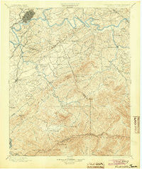
Knoxville, Tennessee, USGS topographic map dated 1901.
Includes geographic coordinates (latitude and longitude). This topographic map is suitable for hiking, camping, and exploring, or framing it as a wall map.
Printed on-demand using high resolution imagery, on heavy weight and acid free paper, or alternatively on a variety of synthetic materials.
Topos available on paper, Waterproof, Poly, or Tyvek. Usually shipping rolled, unless combined with other folded maps in one order.
- Product Number: USGS-5339014
- Free digital map download (high-resolution, GeoPDF): Knoxville, Tennessee (file size: 9 MB)
- Map Size: please refer to the dimensions of the GeoPDF map above
- Weight (paper map): ca. 55 grams
- Map Type: POD USGS Topographic Map
- Map Series: HTMC
- Map Verison: Historical
- Cell ID: 320661
- Scan ID: 153509
- Imprint Year: 1904
- Survey Year: 1890
- Datum: Unstated
- Map Projection: Unstated
- Map published by United States Geological Survey
- Map Language: English
- Scanner Resolution: 600 dpi
- Map Cell Name: Knoxville
- Grid size: 30 X 30 Minute
- Date on map: 1901
- Map Scale: 1:125000
- Geographical region: Tennessee, United States
Neighboring Maps:
All neighboring USGS topo maps are available for sale online at a variety of scales.
Spatial coverage:
Topo map Knoxville, Tennessee, covers the geographical area associated the following places:
- Mountain View Addition - Rocky Branch - Harth Addition - Shooks Gap - Willard Addition - Briarcliff - Duncan - Ewing (historical) - Rivertrace - Belle Meade - Belmont Addition - Dupont Springs - Henry Crossroads - Conner Heights - Tee Lee Heights - West Springbrook - Walland - Asbury - Alder Branch - Eastover - Forest Hills - Dellwood - Shooks - Deep Springs - McMahan - Vestal - Crossfield - Cherokee Park - Knob Creek - Fox Hills - Oaklawn Addition - Gapcreek (historical) - Kinzel Springs - East Forest - Windsor Park - Kodak - Seymour Heights - Cave Mill - Underwood - Midway - Knoxville - Littlebrook - Hatchertown - Lakemont - Forks of the River - Buena Vista - Providence - Reagantown - Twin Oak Estates - Henderson Springs - Cold Springs - Bays Mountain Estates - Neubert Springs - Hornet - Union Hill - Topside - Yettland Park - Oldfield Addition - Woodfield Park - Cook Mill - Old Chilhowee - Glenmore Estates - Red Bank - Ellejoy - Stony Point - Fairview Heights - Alcoa - Mount Olive - Tara Estates - West Haven - Creekwood - Park City - Wilham (historical) - New Hopewell - Eggers Addition - South Knoxville - Elkmont - Lake Forest - High Bluff - Beech Springs - Welwyn (historical) - Arrowhead - South View Estates - Iris Acres - Park Settlement - Bank (historical) - Heritage Hills - Mimosa Estates - Trundle Crossroad - Calderwood - Sequoyah Hills - Spur Trailer Park - Seven Islands - Lincoln Park - Lyons View - Pine Grove - Marble City - Timberlake - Mount Zion - Beechwood
- Map Area ID: AREA3635.5-84-83.5
- Northwest corner Lat/Long code: USGSNW36-84
- Northeast corner Lat/Long code: USGSNE36-83.5
- Southwest corner Lat/Long code: USGSSW35.5-84
- Southeast corner Lat/Long code: USGSSE35.5-83.5
- Northern map edge Latitude: 36
- Southern map edge Latitude: 35.5
- Western map edge Longitude: -84
- Eastern map edge Longitude: -83.5


