
~ Knoxville TN topo map, 1:125000 scale, 30 X 30 Minute, Historical, 1901
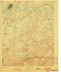
Knoxville, Tennessee, USGS topographic map dated 1901.
Includes geographic coordinates (latitude and longitude). This topographic map is suitable for hiking, camping, and exploring, or framing it as a wall map.
Printed on-demand using high resolution imagery, on heavy weight and acid free paper, or alternatively on a variety of synthetic materials.
Topos available on paper, Waterproof, Poly, or Tyvek. Usually shipping rolled, unless combined with other folded maps in one order.
- Product Number: USGS-5339012
- Free digital map download (high-resolution, GeoPDF): Knoxville, Tennessee (file size: 9 MB)
- Map Size: please refer to the dimensions of the GeoPDF map above
- Weight (paper map): ca. 55 grams
- Map Type: POD USGS Topographic Map
- Map Series: HTMC
- Map Verison: Historical
- Cell ID: 320661
- Scan ID: 153508
- Survey Year: 1890
- Datum: Unstated
- Map Projection: Unstated
- Map published by United States Geological Survey
- Map Language: English
- Scanner Resolution: 600 dpi
- Map Cell Name: Knoxville
- Grid size: 30 X 30 Minute
- Date on map: 1901
- Map Scale: 1:125000
- Geographical region: Tennessee, United States
Neighboring Maps:
All neighboring USGS topo maps are available for sale online at a variety of scales.
Spatial coverage:
Topo map Knoxville, Tennessee, covers the geographical area associated the following places:
- Sevier Heights - Westfields - High Bluff - Wear Valley - Townsend - College Park Estates - Seven Islands - Montvale - Wimbledon - Elajay (historical) - Topside - Creekwood - New Hopewell - Timberlake - Hicks Crossing - Southbrook - Vestal - Cate crossroad - Marble City - Singleton - Belle Meade - New Era - Doyle Springs - Forks of the River - Knoxville - Duncan - Old Chilhowee - Hubbard - Cusick - Hatchertown - Shooks Gap - Bays Mountain Estates - Meades Quarry - Scenic Terrace - Pigeon Forge - Blount Beach - Chandler - West Haven - Meadowbrook - Cherokee Park - Lawson Crossroad - Notime (historical) - Providence - Line Spring - Jackson Hills - Maryville - Park Settlement - Henderson Springs - Bassel Addition - Red Bank - Bonny Kate - West Maryville - Middlebrook Heights - Conner Heights - Powder Springs (historical) - Gatlinburg - Walland - Island Home - Valley Grove - Farrport - Benford Heights Addition - Eagleton Village - Welwyn (historical) - Bittle Heights - Happy Valley - Mooreland Heights - Starkeytown - Willard Addition - Stony Point - Mount Zion - Bayview - Hannum Addition - Gibson Acres Mobile Home Park - Oak City - Williamsburg - Moshina Heights - Sevierville - Melrose - Union Grove - Windsor Park - Kodak - Meadowood - Sherwood Forest - Ramsey - Boyds Creek - South View Estates - Holston Hills - Plainfield addition - Little River - Mountain View Addition - McMahan - Crossfield - Riverdale - Alcoa - Seymour Heights - Lakemoor Hills - Riverbend - Springfield - Cowan Springs - Neubert
- Map Area ID: AREA3635.5-84-83.5
- Northwest corner Lat/Long code: USGSNW36-84
- Northeast corner Lat/Long code: USGSNE36-83.5
- Southwest corner Lat/Long code: USGSSW35.5-84
- Southeast corner Lat/Long code: USGSSE35.5-83.5
- Northern map edge Latitude: 36
- Southern map edge Latitude: 35.5
- Western map edge Longitude: -84
- Eastern map edge Longitude: -83.5


