
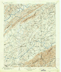
~ Greeneville TN topo map, 1:125000 scale, 30 X 30 Minute, Historical, 1904, updated 1934
Greeneville, Tennessee, USGS topographic map dated 1904.
Includes geographic coordinates (latitude and longitude). This topographic map is suitable for hiking, camping, and exploring, or framing it as a wall map.
Printed on-demand using high resolution imagery, on heavy weight and acid free paper, or alternatively on a variety of synthetic materials.
Topos available on paper, Waterproof, Poly, or Tyvek. Usually shipping rolled, unless combined with other folded maps in one order.
- Product Number: USGS-5338970
- Free digital map download (high-resolution, GeoPDF): Greeneville, Tennessee (file size: 8 MB)
- Map Size: please refer to the dimensions of the GeoPDF map above
- Weight (paper map): ca. 55 grams
- Map Type: POD USGS Topographic Map
- Map Series: HTMC
- Map Verison: Historical
- Cell ID: 65610
- Scan ID: 149826
- Imprint Year: 1934
- Survey Year: 1891
- Datum: Unstated
- Map Projection: Polyconic
- Map published by United States Geological Survey
- Map Language: English
- Scanner Resolution: 600 dpi
- Map Cell Name: Greenville
- Grid size: 30 X 30 Minute
- Date on map: 1904
- Map Scale: 1:125000
- Geographical region: Tennessee, United States
Neighboring Maps:
All neighboring USGS topo maps are available for sale online at a variety of scales.
Spatial coverage:
Topo map Greeneville, Tennessee, covers the geographical area associated the following places:
- Marvin - Poplar Grove - Bethany - Spears (historical) - Vogel (historical) - Rustic Acres - Twin Oaks - Amis - Vernon Heights - Henard Mill - Washington College - Limestone Springs - Westgate - Buckingham Heights - Harris Mill - Oakland - Applewalk Park - Brumley Heights - Greeneville - Petersburg - Rheatown - Blue Ridge Estates - Tusculum - Van Hill - New Hope - Chimneytop (historical) - Pleasant Valley - Pleasant Hill - Craft Spring - Statemount (historical) - Kincheloe Mill - Alexander Mill - Sunnyside - Ernestville - Jearoldstown - Camp Creek - Mayflower (historical) - Holland Mill - Forest Hills - Greystone - Taylor Mill - Longs Bend - Ottway - Robinson Forest - Kepler - Zion Hill - Bright Hope - Kincheloe (historical) - Gregory Subdivision - Horse Creek - Gravel Hill - Haws Crossroads - Home Field Terrace - Clarkson (historical) - Enterprise - Town Acres - Butterfly (historical) - Summer Hills - Conkintown - Telford - Meadowlark - Mountain View Terrace - Bowmantown - Honeys Hill - Rocky Fork - Locust Mount - Mowls Mill - Milburnton - Timber Ridge - Saint James - Lone Star - Cedar Hill - Gabtown - Meadowbrook - Mays Subdivision - Sequoia Hills - Pactolus - Loganton (historical) - Guntown - Summersville - Roaring Springs - Stewart Hill - Fairview - Fall Branch - Upchurch - Green Acres - Butcher (historical) - Keys Mill - Pleasant Vale - Blossom - Big Creek - Broylesville - Conklin - Stowe Acres - Striggersville - Luke (historical) - McDonald Hill - Hickory Cove (historical) - Slaughter (historical) - Leming Subdivision
- Map Area ID: AREA36.536-83-82.5
- Northwest corner Lat/Long code: USGSNW36.5-83
- Northeast corner Lat/Long code: USGSNE36.5-82.5
- Southwest corner Lat/Long code: USGSSW36-83
- Southeast corner Lat/Long code: USGSSE36-82.5
- Northern map edge Latitude: 36.5
- Southern map edge Latitude: 36
- Western map edge Longitude: -83
- Eastern map edge Longitude: -82.5


