
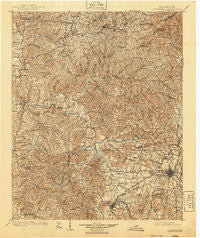
~ Columbia TN topo map, 1:125000 scale, 30 X 30 Minute, Historical, 1901, updated 1940
Columbia, Tennessee, USGS topographic map dated 1901.
Includes geographic coordinates (latitude and longitude). This topographic map is suitable for hiking, camping, and exploring, or framing it as a wall map.
Printed on-demand using high resolution imagery, on heavy weight and acid free paper, or alternatively on a variety of synthetic materials.
Topos available on paper, Waterproof, Poly, or Tyvek. Usually shipping rolled, unless combined with other folded maps in one order.
- Product Number: USGS-5338964
- Free digital map download (high-resolution, GeoPDF): Columbia, Tennessee (file size: 11 MB)
- Map Size: please refer to the dimensions of the GeoPDF map above
- Weight (paper map): ca. 55 grams
- Map Type: POD USGS Topographic Map
- Map Series: HTMC
- Map Verison: Historical
- Cell ID: 65245
- Scan ID: 149582
- Imprint Year: 1940
- Survey Year: 1899
- Datum: NAD
- Map Projection: Polyconic
- Map published by United States Geological Survey
- Map Language: English
- Scanner Resolution: 600 dpi
- Map Cell Name: Columbia
- Grid size: 30 X 30 Minute
- Date on map: 1901
- Map Scale: 1:125000
- Geographical region: Tennessee, United States
Neighboring Maps:
All neighboring USGS topo maps are available for sale online at a variety of scales.
Spatial coverage:
Topo map Columbia, Tennessee, covers the geographical area associated the following places:
- Tidwell - Chester Estates - Forrest Hills - Siglo - Watson - Rolling Acres - Hopewell - Lebanon Heights - Flint Valley (historical) - Kettle Mills - Bond - Matlock Ford - Kenny Brook - Dooley (historical) - Johnsons Mill - Hardy Acres - McCains - Isbell - Kingfield - Green Valley - Lone Oak - Needmore - Zion - Buffalo - Sawdust - Rankin - Mill Creek - Jonesboro (historical) - Graham - Smarden - Boston - Field Crest - Kinderhook - Palestine (historical) - Poplar Creek - Newburg (historical) - Gordonsburg - Ridley - Swan Bluff - Craigfield - Ashwood - Arrow - Fernvale Springs (historical) - Glenhaven - Fogg (historical) - Lick Creek (historical) - Center Star - Spencers Mill - Riverside - Tottys Bend - Maple Spring - Columbia Gardens - Fairview Heights - Chartersville - Rolling Fields - Natco - Redden (historical) - Valley Green Estates - Kraus (historical) - Dukes Store (historical) - New Hope - Beale (historical) - Graymere Manor - Porter - River Heights - Wrigley - Springer Ridge (historical) - Fly - Graytown - New Flys Village - Williamsport - Littlelot - Isom - Grove - Daugherty Estates - Bethel - Canaan - Seth - Athendale - Loco (historical) - Pleasant Hills - Fairfield - Fairview - Mayberry (historical) - Columbia - Clement Lake Estates - Southern Hills - Concord (historical) - Bon Aqua - Hampshire - West Haven - Centerville - Aethra - Twomey - Mowd (historical) - Bel Air - Meadowwood Acres - Primm Springs - Armour Village - Little Rock Mills
- Map Area ID: AREA3635.5-87.5-87
- Northwest corner Lat/Long code: USGSNW36-87.5
- Northeast corner Lat/Long code: USGSNE36-87
- Southwest corner Lat/Long code: USGSSW35.5-87.5
- Southeast corner Lat/Long code: USGSSE35.5-87
- Northern map edge Latitude: 36
- Southern map edge Latitude: 35.5
- Western map edge Longitude: -87.5
- Eastern map edge Longitude: -87


