
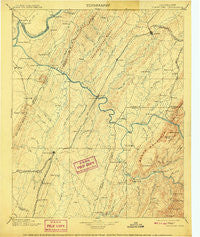
~ Cleveland TN topo map, 1:125000 scale, 30 X 30 Minute, Historical, 1901, updated 1909
Cleveland, Tennessee, USGS topographic map dated 1901.
Includes geographic coordinates (latitude and longitude). This topographic map is suitable for hiking, camping, and exploring, or framing it as a wall map.
Printed on-demand using high resolution imagery, on heavy weight and acid free paper, or alternatively on a variety of synthetic materials.
Topos available on paper, Waterproof, Poly, or Tyvek. Usually shipping rolled, unless combined with other folded maps in one order.
- Product Number: USGS-5338958
- Free digital map download (high-resolution, GeoPDF): Cleveland, Tennessee (file size: 7 MB)
- Map Size: please refer to the dimensions of the GeoPDF map above
- Weight (paper map): ca. 55 grams
- Map Type: POD USGS Topographic Map
- Map Series: HTMC
- Map Verison: Historical
- Cell ID: 65222
- Scan ID: 153507
- Imprint Year: 1909
- Survey Year: 1891
- Datum: Unstated
- Map Projection: Unstated
- Map published by United States Geological Survey
- Map Language: English
- Scanner Resolution: 600 dpi
- Map Cell Name: Cleveland
- Grid size: 30 X 30 Minute
- Date on map: 1901
- Map Scale: 1:125000
- Geographical region: Tennessee, United States
Neighboring Maps:
All neighboring USGS topo maps are available for sale online at a variety of scales.
Spatial coverage:
Topo map Cleveland, Tennessee, covers the geographical area associated the following places:
- McDonald - Chable (historical) - South Cleveland - Meadowview - Harbor Hills - Mountainbrook - Fairview - East Etowah - Riceville - Black Fox - Eureka - Big Spring - Kingwood Estates - Mapleton Hills - Shenandoah - Clear Springs - Sherwood Forest - Clem Jones Heights - Twin Oaks - Hambright - Marina Hills - Sequoia Grove - Williamsburg - Kyle Subdivision - South Liberty - North Etowah - Lamontville - South Rolling Hills - Seven Cedars - Burlington Heights - Gibson Farm Subdivision - Columbus (historical) - Luskville - American Heritage - Ball Play - Ocoee - Mount Vernon - Archville - Conasauga - East Cleveland - Cedar Springs - Union Grove - Jacen Gorbett Subdivision - Misty Ridge - Balltown - Hills and Dales - Wildwood Lake - Beta - Sunset View - Addison - Coile - Willis Springs - Cotton Port (historical) - Bethsalem - Rolling Hills - Grady - Cambria - Zion Hill - Blue Springs - Allen - North Liberty - Fairview - Flint Springs - Ingleside Hill - Westview Heights - Oldfort - Benton Station - Waterville - Caney Creek - Whisperwood - Spring Creek - Pumpkin Center - Villa Heights - Patty - Homestead Acres - Goosetown - Hutsell - Athens - Belleview Estates - Wesleyanna - Chestuee - Austral - Carriage Hills - Davis Heights - Bennett Acres - Etowah - Mashburn - Cedar Spring - Linsdale - Lee Estates - Camp Ocoee - Watt Heights - East View - Grief (historical) - Wetmore - Oak Grove - Georgetown - Etola - Union - Varnell Estates
- Map Area ID: AREA35.535-85-84.5
- Northwest corner Lat/Long code: USGSNW35.5-85
- Northeast corner Lat/Long code: USGSNE35.5-84.5
- Southwest corner Lat/Long code: USGSSW35-85
- Southeast corner Lat/Long code: USGSSE35-84.5
- Northern map edge Latitude: 35.5
- Southern map edge Latitude: 35
- Western map edge Longitude: -85
- Eastern map edge Longitude: -84.5


