
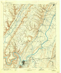
~ Chattanooga TN topo map, 1:125000 scale, 30 X 30 Minute, Historical, 1893, updated 1938
Chattanooga, Tennessee, USGS topographic map dated 1893.
Includes geographic coordinates (latitude and longitude). This topographic map is suitable for hiking, camping, and exploring, or framing it as a wall map.
Printed on-demand using high resolution imagery, on heavy weight and acid free paper, or alternatively on a variety of synthetic materials.
Topos available on paper, Waterproof, Poly, or Tyvek. Usually shipping rolled, unless combined with other folded maps in one order.
- Product Number: USGS-5338928
- Free digital map download (high-resolution, GeoPDF): Chattanooga, Tennessee (file size: 7 MB)
- Map Size: please refer to the dimensions of the GeoPDF map above
- Weight (paper map): ca. 55 grams
- Map Type: POD USGS Topographic Map
- Map Series: HTMC
- Map Verison: Historical
- Cell ID: 65175
- Scan ID: 148919
- Imprint Year: 1938
- Survey Year: 1886
- Datum: Unstated
- Map Projection: Polyconic
- Map published by United States Geological Survey
- Map Language: English
- Scanner Resolution: 600 dpi
- Map Cell Name: Chattnooga
- Grid size: 30 X 30 Minute
- Date on map: 1893
- Map Scale: 1:125000
- Geographical region: Tennessee, United States
Neighboring Maps:
All neighboring USGS topo maps are available for sale online at a variety of scales.
Spatial coverage:
Topo map Chattanooga, Tennessee, covers the geographical area associated the following places:
- Marimont - Montague - Riggs Trailer Park - Fairview - Dallas Heights - Hampton Woods - Brayton - Dallas Hills - Sale Creek - Hixson - Northmont Estates - Prairie Creek - Kings Ridge - Hickory Woods - Dunlap - Riverview - Vista Hills - North Soddy - Dowler Heights - Northwoods - Taylor Hill - Concord Heights - Rivermont - Cartwright - Huntingdon Forest - Lakeshore Estates - Alton Park - Brush Creek - Murray Hills - Ridge Bay - Garden Farms - Shady Rest - Armstrong Trailer Park - Savannah Hills - Soddy Lake Heights - Bakewell - Dana Hills - Ryall Springs - Hampton Heights - North Brainerd - Cross Timbers - Green Gables Mobile Home Park - Brainerd - Ardis Mobile Home Park - Old Farm - Capital Heights - Powells Crossroads - Ponderosa Pines - Paradise Mobile Home Park - Savannah Peninsula - Lake Crest - Towne Hills - Alpine Heights - Holly Heights - Boyce - Shelton Estates - Grindstone Estates - Irongate - Valley Village - Drake Forest - Country Oaks Estates - Logan Heights - Pinebrook Estates - Cherokee Woods - Tiftonia - Harbor Heights - Lower Mill - J And B Mobile Home Park - Washington Place - Bartlebaugh Subdivision - Forestdale - Smithtown - Foxwood Estates - Mowbray - Five Points - Center Point - Olde Mill - Balmoral - Woodmore - Hiddenbrook - Fountain Village - Pinetree Estates - Richland Crest - Forest Park - Jones Mobile Home Park - Fair Meadows Mobile Home Park - Blue Ridge View - Lake Dweller - Shady Grove - Cambridge Estates - Jersey - New Salem - Acres of Shade Mobile Home Park - Middle Valley - North Glen Estates - Dallas Branch - Hendon - Ooltewah - Bryant - Creekwood Terrace
- Map Area ID: AREA35.535-85.5-85
- Northwest corner Lat/Long code: USGSNW35.5-85.5
- Northeast corner Lat/Long code: USGSNE35.5-85
- Southwest corner Lat/Long code: USGSSW35-85.5
- Southeast corner Lat/Long code: USGSSE35-85
- Northern map edge Latitude: 35.5
- Southern map edge Latitude: 35
- Western map edge Longitude: -85.5
- Eastern map edge Longitude: -85


