
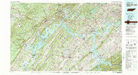
~ Watts Bar Lake TN topo map, 1:100000 scale, 30 X 60 Minute, Historical, 1981, updated 1984
Watts Bar Lake, Tennessee, USGS topographic map dated 1981.
Includes geographic coordinates (latitude and longitude). This topographic map is suitable for hiking, camping, and exploring, or framing it as a wall map.
Printed on-demand using high resolution imagery, on heavy weight and acid free paper, or alternatively on a variety of synthetic materials.
Topos available on paper, Waterproof, Poly, or Tyvek. Usually shipping rolled, unless combined with other folded maps in one order.
- Product Number: USGS-5338894
- Free digital map download (high-resolution, GeoPDF): Watts Bar Lake, Tennessee (file size: 30 MB)
- Map Size: please refer to the dimensions of the GeoPDF map above
- Weight (paper map): ca. 55 grams
- Map Type: POD USGS Topographic Map
- Map Series: HTMC
- Map Verison: Historical
- Cell ID: 68556
- Scan ID: 153427
- Imprint Year: 1984
- Woodland Tint: Yes
- Visual Version Number: 1
- Aerial Photo Year: 1981
- Edit Year: 1981
- Datum: NAD27
- Map Projection: Universal Transverse Mercator
- Map published by Tennessee Valley Authority
- Map Language: English
- Scanner Resolution: 600 dpi
- Map Cell Name: Watts Bar Lake
- Grid size: 30 X 60 Minute
- Date on map: 1981
- Map Scale: 1:100000
- Geographical region: Tennessee, United States
Neighboring Maps:
All neighboring USGS topo maps are available for sale online at a variety of scales.
Spatial coverage:
Topo map Watts Bar Lake, Tennessee, covers the geographical area associated the following places:
- Paint Rock Farm Lake Estates - Christianburg - Sweet Briar - Grassy Cove - Volunteer Village - Glen Alice - Rothwood - Hideaway Hills - Virtue - Brentwood - Eagle Point Heights - Hopewell Mill - Loudon City Park - Scenic Point Estates - Vancouver (historical) - Luttrell - Kingston Hills - Cook Mill - Barton Mill - Jonesville - Pumpkin Center - Old Glory - West Hills - Pumpkin Center - Belle-Aire - Bent Tree - Emory Heights - New Hope - Anglers Cove - Eagle Point - Apollo Shores - Pleasant Hill - Brashears Subdivision - Dixie Lee Junction - Louisville - Reagan - Audubon Hills - Ponderosa - Crestwood - Alleghany (historical) - Crab Orchard - Waldensia - Hartland Estates - Hickory Woods - Robinson Mill - Dodson - Maple Grove - West Hills - Lovell - Rambling Acres - Belmont West - Union - Ponders - Lenoir City - Fourmile Bridge (historical) - Oak Grove Heights - Lanier - Sunnycrest - Solway - Country Haven - Oak Hill - Peninsular Estates - Kiser - Bearden - Dogwood Shores - Scott - Mount Zion - Pennine - Kingston Heights - Gulf Park - Pleasant Hills - Stowe Station - Boggess Crossroad - Eaton Crossroads - Fairview Heights - Arline - Selkirk (historical) - Halfway Town (historical) - Crestwood Hills - Concord - Northpoint - Pine Hills - Cumberland Estates - Decatur - Shady Grove - Sewee - Karns - Green Acres - Dogwood - Westel - Mount Zion - Binfield - Kingston - Iron Hill (historical) - Poplar Springs - Holiday Shores - Midway - Trigonia - Eden of the Lake - Rennbore
- Map Area ID: AREA3635.5-85-84
- Northwest corner Lat/Long code: USGSNW36-85
- Northeast corner Lat/Long code: USGSNE36-84
- Southwest corner Lat/Long code: USGSSW35.5-85
- Southeast corner Lat/Long code: USGSSE35.5-84
- Northern map edge Latitude: 36
- Southern map edge Latitude: 35.5
- Western map edge Longitude: -85
- Eastern map edge Longitude: -84


