
~ Memphis West TN topo map, 1:100000 scale, 30 X 60 Minute, Historical, 1986, updated 1986
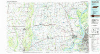
Memphis West, Tennessee, USGS topographic map dated 1986.
Includes geographic coordinates (latitude and longitude). This topographic map is suitable for hiking, camping, and exploring, or framing it as a wall map.
Printed on-demand using high resolution imagery, on heavy weight and acid free paper, or alternatively on a variety of synthetic materials.
Topos available on paper, Waterproof, Poly, or Tyvek. Usually shipping rolled, unless combined with other folded maps in one order.
- Product Number: USGS-5338870
- Free digital map download (high-resolution, GeoPDF): Memphis West, Tennessee (file size: 19 MB)
- Map Size: please refer to the dimensions of the GeoPDF map above
- Weight (paper map): ca. 55 grams
- Map Type: POD USGS Topographic Map
- Map Series: HTMC
- Map Verison: Historical
- Cell ID: 67939
- Scan ID: 148577
- Imprint Year: 1986
- Woodland Tint: Yes
- Aerial Photo Year: 1981
- Edit Year: 1986
- Datum: NAD27
- Map Projection: Universal Transverse Mercator
- Planimetric: Yes
- Map published by United States Geological Survey
- Map Language: English
- Scanner Resolution: 600 dpi
- Map Cell Name: Memphis West
- Grid size: 30 X 60 Minute
- Date on map: 1986
- Map Scale: 1:100000
- Geographical region: Tennessee, United States
Neighboring Maps:
All neighboring USGS topo maps are available for sale online at a variety of scales.
Spatial coverage:
Topo map Memphis West, Tennessee, covers the geographical area associated the following places:
- Felco - Hopefield (historical) - Redman Point - Denwood - Topaz - Shell Lake - Stewart - Togo - Lucerne - Boat Run - Mount Olive - Briark - Smithdale - Nonconnah - Madison - Pinetree - Duvall - Clarkedale - Saint Thomas - Beasley - Pecan Point - Julius - Wynne - Corona - Engledale (historical) - Anthonyville - Harris - Anderson Tully - James Mill - Black Oak - Democrat - Monterey - Lambethville - Cottonwood Corner - Goodman - Almont (historical) - Tarsus - Central - Turney (historical) - Wadell (historical) - Anthony Subdivision - Rosenbaum - Annesdale Park - Forrest City - Saint Claire - Northaven - Galilee - Stonewall Place - Hicks Station - Dunn (historical) - Patoka - Princedale - Memphis - McElroy - Oaklawn - Cherry Valley - Midway - Rosemary Lane - Round Pond - Telico (historical) - Saint Thomas (historical) - Wildcat (historical) - Deckerville - Proctor - Frayser - Mounds - Jericho - Bailes (historical) - Ebony - Blanton - New Shady Grove - Annesdale-Snowden - Hawkins - Mersman - Riceville - Hickory Ridge - Jeanette - Parkin - Waverly - Slonikers Mill - Sylvan Heights - Jennette - Levesque - Lehi - Harvard - Vanndale - Three Forks - Rosine - Kinton - Heafer - Wilkins - West Memphis - Gilmore - Edmondson - Birdsong - Welford (historical) - Joyland - Wildwood - Brushey Lake - Kate
- Map Area ID: AREA35.535-91-90
- Northwest corner Lat/Long code: USGSNW35.5-91
- Northeast corner Lat/Long code: USGSNE35.5-90
- Southwest corner Lat/Long code: USGSSW35-91
- Southeast corner Lat/Long code: USGSSE35-90
- Northern map edge Latitude: 35.5
- Southern map edge Latitude: 35
- Western map edge Longitude: -91
- Eastern map edge Longitude: -90


