
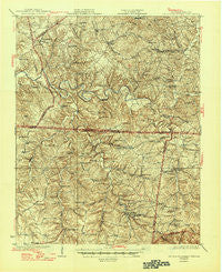
~ Red Boiling Springs TN topo map, 1:62500 scale, 15 X 15 Minute, Historical, 1931, updated 1945
Red Boiling Springs, Tennessee, USGS topographic map dated 1931.
Includes geographic coordinates (latitude and longitude). This topographic map is suitable for hiking, camping, and exploring, or framing it as a wall map.
Printed on-demand using high resolution imagery, on heavy weight and acid free paper, or alternatively on a variety of synthetic materials.
Topos available on paper, Waterproof, Poly, or Tyvek. Usually shipping rolled, unless combined with other folded maps in one order.
- Product Number: USGS-5338782
- Free digital map download (high-resolution, GeoPDF): Red Boiling Springs, Tennessee (file size: 11 MB)
- Map Size: please refer to the dimensions of the GeoPDF map above
- Weight (paper map): ca. 55 grams
- Map Type: POD USGS Topographic Map
- Map Series: HTMC
- Map Verison: Historical
- Cell ID: 72773
- Scan ID: 155927
- Imprint Year: 1945
- Survey Year: 1928
- Datum: NAD
- Map Projection: Polyconic
- Map published by United States Geological Survey
- Map Language: English
- Scanner Resolution: 600 dpi
- Map Cell Name: Red Boiling Springs
- Grid size: 15 X 15 Minute
- Date on map: 1931
- Map Scale: 1:62500
- Geographical region: Tennessee, United States
Neighboring Maps:
All neighboring USGS topo maps are available for sale online at a variety of scales.
Spatial coverage:
Topo map Red Boiling Springs, Tennessee, covers the geographical area associated the following places:
- Galen - Frog Pond - Webbtown - Sunrise - Drapers Crossroads - Hermitage Springs - Gum Tree - Fountain Run - Flippin - Days Crossroads - Spivey - Underwood - Bugtussle - Gamaliel - Akersville - Jenkins Village - Smith Chapel - Pumpkintown - Freetown - Walnut Shade - Red Boiling Springs - Emberton - White Oak - Leonard - Greenwood - Winklers Crossroads - Sycamore Valley - Enon - Bakerton
- Map Area ID: AREA36.7536.5-86-85.75
- Northwest corner Lat/Long code: USGSNW36.75-86
- Northeast corner Lat/Long code: USGSNE36.75-85.75
- Southwest corner Lat/Long code: USGSSW36.5-86
- Southeast corner Lat/Long code: USGSSE36.5-85.75
- Northern map edge Latitude: 36.75
- Southern map edge Latitude: 36.5
- Western map edge Longitude: -86
- Eastern map edge Longitude: -85.75


