
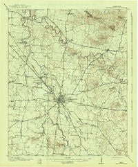
~ Murfreesboro TN topo map, 1:62500 scale, 15 X 15 Minute, Historical, 1916, updated 1941
Murfreesboro, Tennessee, USGS topographic map dated 1916.
Includes geographic coordinates (latitude and longitude). This topographic map is suitable for hiking, camping, and exploring, or framing it as a wall map.
Printed on-demand using high resolution imagery, on heavy weight and acid free paper, or alternatively on a variety of synthetic materials.
Topos available on paper, Waterproof, Poly, or Tyvek. Usually shipping rolled, unless combined with other folded maps in one order.
- Product Number: USGS-5338766
- Free digital map download (high-resolution, GeoPDF): Murfreesboro, Tennessee (file size: 5 MB)
- Map Size: please refer to the dimensions of the GeoPDF map above
- Weight (paper map): ca. 55 grams
- Map Type: POD USGS Topographic Map
- Map Series: HTMC
- Map Verison: Historical
- Cell ID: 58197
- Scan ID: 150179
- Imprint Year: 1941
- Visual Version Number: 1
- Survey Year: 1914
- Datum: Unstated
- Map Projection: Polyconic
- Map published by United States Geological Survey
- Map Language: English
- Scanner Resolution: 600 dpi
- Map Cell Name: Murfreesboro
- Grid size: 15 X 15 Minute
- Date on map: 1916
- Map Scale: 1:62500
- Geographical region: Tennessee, United States
Neighboring Maps:
All neighboring USGS topo maps are available for sale online at a variety of scales.
Spatial coverage:
Topo map Murfreesboro, Tennessee, covers the geographical area associated the following places:
- Hickory Hills - Timberlake - Creekwood - Brownview Acres - Old South Estates - Riverview - Lascassas Colonial Acres - Pioneer Estates - K C Subdivision - Stonebrook - Mount Olive (historical) - Mount Tabor - Cherry Hill Estates - Ridgefield - Riverdale - Burns Place - Kings Estates - Kimbro Heights - White Haven - Barfield - Manson Manor - Parkwood Estates - Miller Estates - Hooper Acres - Juniper Acres - Joyceland - Franklin Road Estates - Southern Aire - Colonial Village - Tulip Hill Estates - Rowland Estates - Williamsburg - Glaze - Blackman - Northpointe Hall - Mount Olive - Fieldcrest - Sunnyside - Kittrell Heights - Ridgecrest Acres - Royal Court - Meadow Lane - Battleground Estates - Compton Meadows - Riverwood - Halewood Hills - Twin Springs - Barfield Meadows - Crescent - Creekmont - Oak Hill - Deerfield - Hales Camp - Canebrake - Beasley Road - Watson - Salem - Hickory Grove - Blansett Meadows - Estes Acres - Farmington Estates - Ravenwood - Fairfield Estates - Leanna - Scotland Acres - Country Park - Shiloh - BAttlefield Meadows - Reynolds - Hillwood Estates - Manson Park - Fox Camp Meadows - River Shores - Double Springs - Two Hills - Briarwood - Jamestown - Saint Johns - Bethel - Overall - Lascassas - Glendale - Murfreesboro - Paschal Estates - Walter Hill Estates - Cherry Lane Acres - Lamb - Henry Lane - Sharpsville - Brian Manor - Young Subdivision - Greenbriar - Butler Estates - Oakwood - Georgetown - Compton - Walterhill - Mona - Cooks Corner - Indian Springs
- Map Area ID: AREA3635.75-86.5-86.25
- Northwest corner Lat/Long code: USGSNW36-86.5
- Northeast corner Lat/Long code: USGSNE36-86.25
- Southwest corner Lat/Long code: USGSSW35.75-86.5
- Southeast corner Lat/Long code: USGSSE35.75-86.25
- Northern map edge Latitude: 36
- Southern map edge Latitude: 35.75
- Western map edge Longitude: -86.5
- Eastern map edge Longitude: -86.25


