
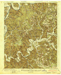
~ Lillydale TN topo map, 1:62500 scale, 15 X 15 Minute, Historical, 1929
Lillydale, Tennessee, USGS topographic map dated 1929.
Includes geographic coordinates (latitude and longitude). This topographic map is suitable for hiking, camping, and exploring, or framing it as a wall map.
Printed on-demand using high resolution imagery, on heavy weight and acid free paper, or alternatively on a variety of synthetic materials.
Topos available on paper, Waterproof, Poly, or Tyvek. Usually shipping rolled, unless combined with other folded maps in one order.
- Product Number: USGS-5338734
- Free digital map download (high-resolution, GeoPDF): Lillydale, Tennessee (file size: 12 MB)
- Map Size: please refer to the dimensions of the GeoPDF map above
- Weight (paper map): ca. 55 grams
- Map Type: POD USGS Topographic Map
- Map Series: HTMC
- Map Verison: Historical
- Cell ID: 56695
- Scan ID: 153419
- Woodland Tint: Yes
- Survey Year: 1926
- Datum: NAD
- Map Projection: Polyconic
- Map published by United States Geological Survey
- Map Language: English
- Scanner Resolution: 600 dpi
- Map Cell Name: Lillydale
- Grid size: 15 X 15 Minute
- Date on map: 1929
- Map Scale: 1:62500
- Geographical region: Tennessee, United States
Neighboring Maps:
All neighboring USGS topo maps are available for sale online at a variety of scales.
Spatial coverage:
Topo map Lillydale, Tennessee, covers the geographical area associated the following places:
- Long Ridge - Bear Wallow Ridge (historical) - Pea Ridge - Cave Springs - Shanky Branch - Taylors Crossroads - Modoc - Green Grove - Martinsburg - Peytonsburg - Lillydale (historical) - Judio - Free Hill - Hobart - Stalcup - Frogue - Poplar Grove (historical) - Hegira - Kettle - Willow Grove - Oakley - Neely Crossroads - Ashlock - Fairview - Ozone - Tanbark - Raydure - Saint John - Thompsons Store - Fox Springs (historical) - Littrell
- Map Area ID: AREA36.7536.5-85.5-85.25
- Northwest corner Lat/Long code: USGSNW36.75-85.5
- Northeast corner Lat/Long code: USGSNE36.75-85.25
- Southwest corner Lat/Long code: USGSSW36.5-85.5
- Southeast corner Lat/Long code: USGSSE36.5-85.25
- Northern map edge Latitude: 36.75
- Southern map edge Latitude: 36.5
- Western map edge Longitude: -85.5
- Eastern map edge Longitude: -85.25


