
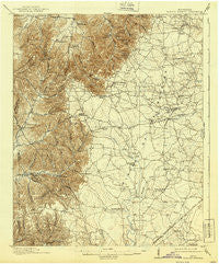
~ Hollow Springs TN topo map, 1:62500 scale, 15 X 15 Minute, Historical, 1913, updated 1939
Hollow Springs, Tennessee, USGS topographic map dated 1913.
Includes geographic coordinates (latitude and longitude). This topographic map is suitable for hiking, camping, and exploring, or framing it as a wall map.
Printed on-demand using high resolution imagery, on heavy weight and acid free paper, or alternatively on a variety of synthetic materials.
Topos available on paper, Waterproof, Poly, or Tyvek. Usually shipping rolled, unless combined with other folded maps in one order.
- Product Number: USGS-5338716
- Free digital map download (high-resolution, GeoPDF): Hollow Springs, Tennessee (file size: 8 MB)
- Map Size: please refer to the dimensions of the GeoPDF map above
- Weight (paper map): ca. 55 grams
- Map Type: POD USGS Topographic Map
- Map Series: HTMC
- Map Verison: Historical
- Cell ID: 55392
- Scan ID: 147997
- Imprint Year: 1939
- Survey Year: 1911
- Datum: NAD
- Map Projection: Polyconic
- Map published by United States Geological Survey
- Map Language: English
- Scanner Resolution: 600 dpi
- Map Cell Name: Hollow Springs
- Grid size: 15 X 15 Minute
- Date on map: 1913
- Map Scale: 1:62500
- Geographical region: Tennessee, United States
Neighboring Maps:
All neighboring USGS topo maps are available for sale online at a variety of scales.
Spatial coverage:
Topo map Hollow Springs, Tennessee, covers the geographical area associated the following places:
- Midway - Parker Hill - Rocky Point (historical) - Coldwater (historical) - Burgen - New Union - Pocahontas - Boynton Valley - Donnell Chapel - Gnat Hill - Lewis Store - Forest Mill - Brooksville (historical) - Hoodoo - Red Hill - Circle J Park - Manchester Mobile Home Park - Strauss Mill - Holly (historical) - Gossburg - Ragsdale - Fredonia - Carman (historical) - McMahan - Geedville - Walkersville (historical) - Mud Creek - Ivy Bluff - Baucom - Hopewell (historical) - Thyatira (historical) - Beechgrove - Hollow Springs - Bradyville - Tolbertsville (historical) - Noah - Fudgearound - Wildwood Mill - Amity - Teal (historical) - Robinson (historical) - Farrar Hill - Mooretown - Jernigan (historical) - Naola (historical) - Simmons Chapel - Busy Corner
- Map Area ID: AREA35.7535.5-86.25-86
- Northwest corner Lat/Long code: USGSNW35.75-86.25
- Northeast corner Lat/Long code: USGSNE35.75-86
- Southwest corner Lat/Long code: USGSSW35.5-86.25
- Southeast corner Lat/Long code: USGSSE35.5-86
- Northern map edge Latitude: 35.75
- Southern map edge Latitude: 35.5
- Western map edge Longitude: -86.25
- Eastern map edge Longitude: -86


