
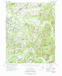
~ Atwood TN topo map, 1:62500 scale, 15 X 15 Minute, Historical, 1977, updated 1977
Atwood, Tennessee, USGS topographic map dated 1977.
Includes geographic coordinates (latitude and longitude). This topographic map is suitable for hiking, camping, and exploring, or framing it as a wall map.
Printed on-demand using high resolution imagery, on heavy weight and acid free paper, or alternatively on a variety of synthetic materials.
Topos available on paper, Waterproof, Poly, or Tyvek. Usually shipping rolled, unless combined with other folded maps in one order.
- Product Number: USGS-5338630
- Free digital map download (high-resolution, GeoPDF): Atwood, Tennessee (file size: 9 MB)
- Map Size: please refer to the dimensions of the GeoPDF map above
- Weight (paper map): ca. 55 grams
- Map Type: POD USGS Topographic Map
- Map Series: HTMC
- Map Verison: Historical
- Cell ID: 50783
- Scan ID: 143618
- Imprint Year: 1977
- Woodland Tint: Yes
- Aerial Photo Year: 1966
- Field Check Year: 1974
- Datum: NAD27
- Map Projection: Polyconic
- Map published by United States Army Corps of Engineers
- Map Language: English
- Scanner Resolution: 600 dpi
- Map Cell Name: Atwood
- Grid size: 15 X 15 Minute
- Date on map: 1977
- Map Scale: 1:62500
- Geographical region: Tennessee, United States
Neighboring Maps:
All neighboring USGS topo maps are available for sale online at a variety of scales.
Spatial coverage:
Topo map Atwood, Tennessee, covers the geographical area associated the following places:
- Spain (historical) - Lavinia - Howley - Ledbetter - McLemoresville - Spring Creek - Atwood - Utley (historical) - Whitthorne - Sharon - Cedar Grove - Woodhill (historical) - Mount Gilead - Howse - Hickory Flat - Hopewell - Smith - New Hope (historical) - Graball - McHaney (historical) - Terry - Carters Chapel - Law
- Map Area ID: AREA3635.75-88.75-88.5
- Northwest corner Lat/Long code: USGSNW36-88.75
- Northeast corner Lat/Long code: USGSNE36-88.5
- Southwest corner Lat/Long code: USGSSW35.75-88.75
- Southeast corner Lat/Long code: USGSSE35.75-88.5
- Northern map edge Latitude: 36
- Southern map edge Latitude: 35.75
- Western map edge Longitude: -88.75
- Eastern map edge Longitude: -88.5


