
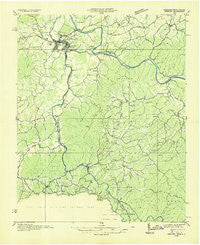
~ Newport TN topo map, 1:48000 scale, 15 X 15 Minute, Historical, 1935
Newport, Tennessee, USGS topographic map dated 1935.
Includes geographic coordinates (latitude and longitude). This topographic map is suitable for hiking, camping, and exploring, or framing it as a wall map.
Printed on-demand using high resolution imagery, on heavy weight and acid free paper, or alternatively on a variety of synthetic materials.
Topos available on paper, Waterproof, Poly, or Tyvek. Usually shipping rolled, unless combined with other folded maps in one order.
- Product Number: USGS-5338604
- Free digital map download (high-resolution, GeoPDF): Newport, Tennessee (file size: 8 MB)
- Map Size: please refer to the dimensions of the GeoPDF map above
- Weight (paper map): ca. 55 grams
- Map Type: POD USGS Topographic Map
- Map Series: HTMC
- Map Verison: Historical
- Cell ID: 58418
- Scan ID: 149252
- Woodland Tint: Yes
- Field Check Year: 1935
- Datum: NAD27
- Map Projection: Polyconic
- Advance: Yes
- Planimetric: Yes
- Map published by Tennessee Valley Authority
- Map Language: English
- Scanner Resolution: 600 dpi
- Map Cell Name: Newport
- Grid size: 15 X 15 Minute
- Date on map: 1935
- Map Scale: 1:48000
- Geographical region: Tennessee, United States
Neighboring Maps:
All neighboring USGS topo maps are available for sale online at a variety of scales.
Spatial coverage:
Topo map Newport, Tennessee, covers the geographical area associated the following places:
- Newport - Midway - Wilsonville - Tom Town - Crestmont - Read Hill - Cosby - Baltimore - Hartford - Jaybird - West End - Bat Harbor - Browns - Bluffton - Pleasant Grove - Wilton Springs - Gum Spring - Grassy Fork - Finney Patch - Click Mill - Edwina - Irish Cut - Mount Sterling - Naillon (historical) - Waterville - Allen Grove - English Creek - Catons Grove - Eastport - Del Rio - Nough - Raven Branch - Forest Hill - Jimtown - Padgett Mill - Naillontown (historical) - Oldtown - West Myers - Denton - Long Creek - Castle Heights - Bridgeport - Jenkins Mill - Licklog - London - Northport
- Map Area ID: AREA3635.75-83.25-83
- Northwest corner Lat/Long code: USGSNW36-83.25
- Northeast corner Lat/Long code: USGSNE36-83
- Southwest corner Lat/Long code: USGSSW35.75-83.25
- Southeast corner Lat/Long code: USGSSE35.75-83
- Northern map edge Latitude: 36
- Southern map edge Latitude: 35.75
- Western map edge Longitude: -83.25
- Eastern map edge Longitude: -83


