
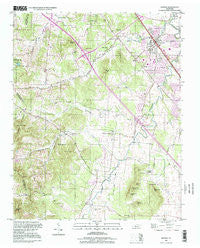
~ Smyrna TN topo map, 1:24000 scale, 7.5 X 7.5 Minute, Historical, 1998, updated 1999
Smyrna, Tennessee, USGS topographic map dated 1998.
Includes geographic coordinates (latitude and longitude). This topographic map is suitable for hiking, camping, and exploring, or framing it as a wall map.
Printed on-demand using high resolution imagery, on heavy weight and acid free paper, or alternatively on a variety of synthetic materials.
Topos available on paper, Waterproof, Poly, or Tyvek. Usually shipping rolled, unless combined with other folded maps in one order.
- Product Number: USGS-5337550
- Free digital map download (high-resolution, GeoPDF): Smyrna, Tennessee (file size: 12 MB)
- Map Size: please refer to the dimensions of the GeoPDF map above
- Weight (paper map): ca. 55 grams
- Map Type: POD USGS Topographic Map
- Map Series: HTMC
- Map Verison: Historical
- Cell ID: 41849
- Scan ID: 148708
- Imprint Year: 1999
- Woodland Tint: Yes
- Photo Inspection Year: 1998
- Aerial Photo Year: 1980
- Datum: NAD27
- Map Projection: Lambert Conformal Conic
- Map published by United States Geological Survey
- Map Language: English
- Scanner Resolution: 600 dpi
- Map Cell Name: Smyrna
- Grid size: 7.5 X 7.5 Minute
- Date on map: 1998
- Map Scale: 1:24000
- Geographical region: Tennessee, United States
Neighboring Maps:
All neighboring USGS topo maps are available for sale online at a variety of scales.
Spatial coverage:
Topo map Smyrna, Tennessee, covers the geographical area associated the following places:
- Sagefield - Creekside - Rosswood - Rosewood Park - Foxland Forest - Rocky Fork - Marathon Trail - Glenrose Park - Hilltop - Emmitt Heights - Smyrna - Valley Green Acres - Green Acres - Bluefield - Belle Mead - Stone Ridge - Tarrytown Estates - Walnut Ridge - Loafers Corner - Davis Meadows - Southern Meadows - Aberdeen Park - McAndore Estates - Oak Valley - Little Hope - Quail Ridge - Haynes - Jordan Acres - Rocksprings - Shadowbrook - Neal Circle
- Map Area ID: AREA3635.875-86.625-86.5
- Northwest corner Lat/Long code: USGSNW36-86.625
- Northeast corner Lat/Long code: USGSNE36-86.5
- Southwest corner Lat/Long code: USGSSW35.875-86.625
- Southeast corner Lat/Long code: USGSSE35.875-86.5
- Northern map edge Latitude: 36
- Southern map edge Latitude: 35.875
- Western map edge Longitude: -86.625
- Eastern map edge Longitude: -86.5


