
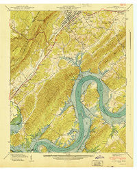
~ Rockwood TN topo map, 1:24000 scale, 7.5 X 7.5 Minute, Historical, 1940
Rockwood, Tennessee, USGS topographic map dated 1940.
Includes geographic coordinates (latitude and longitude). This topographic map is suitable for hiking, camping, and exploring, or framing it as a wall map.
Printed on-demand using high resolution imagery, on heavy weight and acid free paper, or alternatively on a variety of synthetic materials.
Topos available on paper, Waterproof, Poly, or Tyvek. Usually shipping rolled, unless combined with other folded maps in one order.
- Product Number: USGS-5337212
- Free digital map download (high-resolution, GeoPDF): Rockwood, Tennessee (file size: 15 MB)
- Map Size: please refer to the dimensions of the GeoPDF map above
- Weight (paper map): ca. 55 grams
- Map Type: POD USGS Topographic Map
- Map Series: HTMC
- Map Verison: Historical
- Cell ID: 38352
- Scan ID: 153021
- Woodland Tint: Yes
- Field Check Year: 1939
- Datum: NAD27
- Map Projection: Polyconic
- Preliminary map: Yes
- Map published by Tennessee Valley Authority
- Map Language: English
- Scanner Resolution: 600 dpi
- Map Cell Name: Rockwood
- Grid size: 7.5 X 7.5 Minute
- Date on map: 1940
- Map Scale: 1:24000
- Geographical region: Tennessee, United States
Neighboring Maps:
All neighboring USGS topo maps are available for sale online at a variety of scales.
Spatial coverage:
Topo map Rockwood, Tennessee, covers the geographical area associated the following places:
- Terrace View - Harbin - Glen Alice - Webster - Post Oak Farms - Dogwood Heights - Pioneer Village - Pond Grove - Eagle Furnace - Woodland Cove - Postoak - Rockwood - Eureka - Kimbros (historical) - Shenandoah Estates - Eagle Point Heights - New Hope - Shorewood - Lakemont Heights - Eagle Point Cabin Area - Bay View - Cannon Subdivision - Hillcrest - Parkview - Smoke Rise - King Creek (historical) - Irwinton Shores - Cove Point - Highland Forest - Bella Mara Estates
- Map Area ID: AREA35.87535.75-84.75-84.625
- Northwest corner Lat/Long code: USGSNW35.875-84.75
- Northeast corner Lat/Long code: USGSNE35.875-84.625
- Southwest corner Lat/Long code: USGSSW35.75-84.75
- Southeast corner Lat/Long code: USGSSE35.75-84.625
- Northern map edge Latitude: 35.875
- Southern map edge Latitude: 35.75
- Western map edge Longitude: -84.75
- Eastern map edge Longitude: -84.625


