
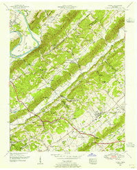
~ Powell TN topo map, 1:24000 scale, 7.5 X 7.5 Minute, Historical, 1952, updated 1955
Powell, Tennessee, USGS topographic map dated 1952.
Includes geographic coordinates (latitude and longitude). This topographic map is suitable for hiking, camping, and exploring, or framing it as a wall map.
Printed on-demand using high resolution imagery, on heavy weight and acid free paper, or alternatively on a variety of synthetic materials.
Topos available on paper, Waterproof, Poly, or Tyvek. Usually shipping rolled, unless combined with other folded maps in one order.
- Product Number: USGS-5337034
- Free digital map download (high-resolution, GeoPDF): Powell, Tennessee (file size: 14 MB)
- Map Size: please refer to the dimensions of the GeoPDF map above
- Weight (paper map): ca. 55 grams
- Map Type: POD USGS Topographic Map
- Map Series: HTMC
- Map Verison: Historical
- Cell ID: 36263
- Scan ID: 155538
- Imprint Year: 1955
- Woodland Tint: Yes
- Aerial Photo Year: 1952
- Edit Year: 1952
- Datum: NAD27
- Map Projection: Polyconic
- Map published by Tennessee Valley Authority
- Map Language: English
- Scanner Resolution: 600 dpi
- Map Cell Name: Powell
- Grid size: 7.5 X 7.5 Minute
- Date on map: 1952
- Map Scale: 1:24000
- Geographical region: Tennessee, United States
Neighboring Maps:
All neighboring USGS topo maps are available for sale online at a variety of scales.
Spatial coverage:
Topo map Powell, Tennessee, covers the geographical area associated the following places:
- Sites Mobile Home Park - Claxton - Grand Oaks - Peak - Cumberland View Mobile Home Park - Lazy Acres - Powell - Spring Hill - Lakewood - Heiskell - Mayview Heights - Idlewood Acres - Ponderosa Hills - Treeville - Bull Run - Cherrybrook - Powell Heights - Deep Springs - Washington Heights - Bell Bridge - Shadow Wood - Northhampton Acres - Broad Acres - Cherokee Ridge - Twi-lite Zone Mobile Home Park - Glenwood
- Map Area ID: AREA36.12536-84.125-84
- Northwest corner Lat/Long code: USGSNW36.125-84.125
- Northeast corner Lat/Long code: USGSNE36.125-84
- Southwest corner Lat/Long code: USGSSW36-84.125
- Southeast corner Lat/Long code: USGSSE36-84
- Northern map edge Latitude: 36.125
- Southern map edge Latitude: 36
- Western map edge Longitude: -84.125
- Eastern map edge Longitude: -84


