
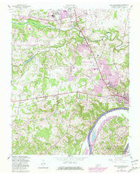
~ New Providence TN topo map, 1:24000 scale, 7.5 X 7.5 Minute, Historical, 1957, updated 1981
New Providence, Tennessee, USGS topographic map dated 1957.
Includes geographic coordinates (latitude and longitude). This topographic map is suitable for hiking, camping, and exploring, or framing it as a wall map.
Printed on-demand using high resolution imagery, on heavy weight and acid free paper, or alternatively on a variety of synthetic materials.
Topos available on paper, Waterproof, Poly, or Tyvek. Usually shipping rolled, unless combined with other folded maps in one order.
- Product Number: USGS-5336456
- Free digital map download (high-resolution, GeoPDF): New Providence, Tennessee (file size: 14 MB)
- Map Size: please refer to the dimensions of the GeoPDF map above
- Weight (paper map): ca. 55 grams
- Map Type: POD USGS Topographic Map
- Map Series: HTMC
- Map Verison: Historical
- Cell ID: 31829
- Scan ID: 149249
- Imprint Year: 1981
- Woodland Tint: Yes
- Photo Revision Year: 1980
- Aerial Photo Year: 1975
- Edit Year: 1980
- Field Check Year: 1957
- Datum: NAD27
- Map Projection: Polyconic
- Map published by United States Army Corps of Engineers
- Map Language: English
- Scanner Resolution: 600 dpi
- Map Cell Name: New Providence
- Grid size: 7.5 X 7.5 Minute
- Date on map: 1957
- Map Scale: 1:24000
- Geographical region: Tennessee, United States
Neighboring Maps:
All neighboring USGS topo maps are available for sale online at a variety of scales.
Spatial coverage:
Topo map New Providence, Tennessee, covers the geographical area associated the following places:
- Ringgold Acres - Sherwood Forest - Northwood Terrace - Southaven - Meadowbrook - Bel-Air Estates - Rosehill Estates - Woodlawn Estates - Cedargold - North Haven - Park Lane - Brentwood - Millswood Estates - Belleglade - Ringgold - Boyd Acres - Countrybrook - North Park - Boxcroft - Oakland Heights - Story Book Acres - Kenwood - Johnson Heights - Louise Heights - Hermitage Estates - Belle Forest - Ranch Hill - Darnell Estates - Montgomery Estates - Fountainbleau - Peachers Mill - Lintwood Heights - Briarwood - Morrison Estates - West Fork Hills - Dale Terrace - New Providence
- Map Area ID: AREA36.62536.5-87.5-87.375
- Northwest corner Lat/Long code: USGSNW36.625-87.5
- Northeast corner Lat/Long code: USGSNE36.625-87.375
- Southwest corner Lat/Long code: USGSSW36.5-87.5
- Southeast corner Lat/Long code: USGSSE36.5-87.375
- Northern map edge Latitude: 36.625
- Southern map edge Latitude: 36.5
- Western map edge Longitude: -87.5
- Eastern map edge Longitude: -87.375


