
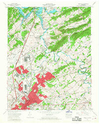
~ Maryville TN topo map, 1:24000 scale, 7.5 X 7.5 Minute, Historical, 1966, updated 1968
Maryville, Tennessee, USGS topographic map dated 1966.
Includes geographic coordinates (latitude and longitude). This topographic map is suitable for hiking, camping, and exploring, or framing it as a wall map.
Printed on-demand using high resolution imagery, on heavy weight and acid free paper, or alternatively on a variety of synthetic materials.
Topos available on paper, Waterproof, Poly, or Tyvek. Usually shipping rolled, unless combined with other folded maps in one order.
- Product Number: USGS-5335944
- Free digital map download (high-resolution, GeoPDF): Maryville, Tennessee (file size: 13 MB)
- Map Size: please refer to the dimensions of the GeoPDF map above
- Weight (paper map): ca. 55 grams
- Map Type: POD USGS Topographic Map
- Map Series: HTMC
- Map Verison: Historical
- Cell ID: 27929
- Scan ID: 149082
- Imprint Year: 1968
- Woodland Tint: Yes
- Visual Version Number: 1
- Aerial Photo Year: 1966
- Edit Year: 1966
- Field Check Year: 1966
- Datum: NAD27
- Map Projection: Polyconic
- Map published by Tennessee Valley Authority
- Map Language: English
- Scanner Resolution: 600 dpi
- Map Cell Name: Maryville
- Grid size: 7.5 X 7.5 Minute
- Date on map: 1966
- Map Scale: 1:24000
- Geographical region: Tennessee, United States
Neighboring Maps:
All neighboring USGS topo maps are available for sale online at a variety of scales.
Spatial coverage:
Topo map Maryville, Tennessee, covers the geographical area associated the following places:
- Cherokee Park - Lakeview Estates - East Springbrook - Asbury Estates - Westfields - Singleton - Woodmont Addition - Littlebrook - Amerene (historical) - Fox Hills - Twin Oak Estates - Duncan - Eagleton Village - Rivertrace - Oldfield Addition - Stock Creek - Farrport - Peppermint Hills - Rocky Waters - Lakemont - Grandview Heights - West Maryville - Iris Acres - West Springbrook - Meadowbrook - Scenic Terrace - Rivertrace - Benford Heights Addition - Little River - Tara Estates - Vose - Rockford - Mountain Trace - Bassel Addition - Hubbard - Chandler - Cave Mill - Blount Beach - Springfield - Mimosa Estates - Alcoa - Plainfield - Jackson Hills - Harth Addition - Edgewood Acres - Maryville - Beechwood - South Hall - Bungalow - Bank (historical) - Oakhurst - Hillsdale - Meadowood - Everett Heights - Notime (historical) - Airport Plaza - Twelve Oaks - Mimosa Heights - Hannum Addition - Springbrook - Ford Addition - Belmont Addition - Dellwood - Eggers Addition - Rockgardens - Glenmore Estates - Plainfield addition - Sevier Heights - Summit Hills - Bittle Heights
- Map Area ID: AREA35.87535.75-84-83.875
- Northwest corner Lat/Long code: USGSNW35.875-84
- Northeast corner Lat/Long code: USGSNE35.875-83.875
- Southwest corner Lat/Long code: USGSSW35.75-84
- Southeast corner Lat/Long code: USGSSE35.75-83.875
- Northern map edge Latitude: 35.875
- Southern map edge Latitude: 35.75
- Western map edge Longitude: -84
- Eastern map edge Longitude: -83.875


