
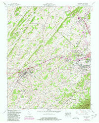
~ Jonesboro TN topo map, 1:24000 scale, 7.5 X 7.5 Minute, Historical, 1959, updated 1981
Jonesboro, Tennessee, USGS topographic map dated 1959.
Includes geographic coordinates (latitude and longitude). This topographic map is suitable for hiking, camping, and exploring, or framing it as a wall map.
Printed on-demand using high resolution imagery, on heavy weight and acid free paper, or alternatively on a variety of synthetic materials.
Topos available on paper, Waterproof, Poly, or Tyvek. Usually shipping rolled, unless combined with other folded maps in one order.
- Product Number: USGS-5335316
- Free digital map download (high-resolution, GeoPDF): Jonesboro, Tennessee (file size: 14 MB)
- Map Size: please refer to the dimensions of the GeoPDF map above
- Weight (paper map): ca. 55 grams
- Map Type: POD USGS Topographic Map
- Map Series: HTMC
- Map Verison: Historical
- Cell ID: 22775
- Scan ID: 147888
- Imprint Year: 1981
- Woodland Tint: Yes
- Photo Revision Year: 1968
- Aerial Photo Year: 1968
- Datum: NAD27
- Map Projection: Polyconic
- Map published by Tennessee Valley Authority
- Map Language: English
- Scanner Resolution: 600 dpi
- Map Cell Name: Jonesborough
- Grid size: 7.5 X 7.5 Minute
- Date on map: 1959
- Map Scale: 1:24000
- Geographical region: Tennessee, United States
Neighboring Maps:
All neighboring USGS topo maps are available for sale online at a variety of scales.
Spatial coverage:
Topo map Jonesboro, Tennessee, covers the geographical area associated the following places:
- Maison - Beechwood Court - South Gate - Y Section - McKinley Mobile Home Park - Camelot - Avondale Forest - Millercrest - Forest Hills - Greenfield Heights - Clark Manor - Hill-N-Dale - Nanatlugunyi (historical) - Skyline Heights - Midway - Charbray - Carter Crossing - Onks - Cherokee - Woodlawn - Sandy Ridge Mobile Home Park - Westover - Holmes - North Johnson City - Carter Sell - Reeves - Tamarack - Ramblewood - Pine Timbers - Camelot Two - Hale - Greenwood - Timber Ridge - Spring City Mobile Home Park - Summit - Green Hill - Seminole Woods - Greenfields - Tamassee - Carmel Village - Boone Trail - Brentwood - Seaton Subdivision - West Hills - The Y - Wellington Park - Foxxborough - West Oakland Park - Timberlake - Asbury - Montclair - Westover Hills - Westwood-Gray Subdivision - February - Towne Acres - Belmont Acres - Greenacres - Washington Heights - McKinley - Roundtree - North Acres - South Ridge Estates - Forest View - Miller - Jonesborough - Woodhill Addition - Knob Creek Mill - Arbor Heights - Colony Park - North Hills - Sequoyah Heights - Carmol - Keebler Crossroads - Dove (historical) - Cherokee Gardens - Sherwood Forest
- Map Area ID: AREA36.37536.25-82.5-82.375
- Northwest corner Lat/Long code: USGSNW36.375-82.5
- Northeast corner Lat/Long code: USGSNE36.375-82.375
- Southwest corner Lat/Long code: USGSSW36.25-82.5
- Southeast corner Lat/Long code: USGSSE36.25-82.375
- Northern map edge Latitude: 36.375
- Southern map edge Latitude: 36.25
- Western map edge Longitude: -82.5
- Eastern map edge Longitude: -82.375


