
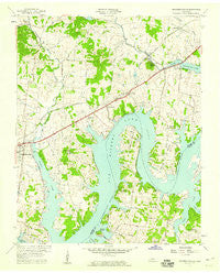
~ Hendersonville TN topo map, 1:24000 scale, 7.5 X 7.5 Minute, Historical, 1957, updated 1959
Hendersonville, Tennessee, USGS topographic map dated 1957.
Includes geographic coordinates (latitude and longitude). This topographic map is suitable for hiking, camping, and exploring, or framing it as a wall map.
Printed on-demand using high resolution imagery, on heavy weight and acid free paper, or alternatively on a variety of synthetic materials.
Topos available on paper, Waterproof, Poly, or Tyvek. Usually shipping rolled, unless combined with other folded maps in one order.
- Product Number: USGS-5334854
- Free digital map download (high-resolution, GeoPDF): Hendersonville, Tennessee (file size: 10 MB)
- Map Size: please refer to the dimensions of the GeoPDF map above
- Weight (paper map): ca. 55 grams
- Map Type: POD USGS Topographic Map
- Map Series: HTMC
- Map Verison: Historical
- Cell ID: 20091
- Scan ID: 147676
- Imprint Year: 1959
- Woodland Tint: Yes
- Aerial Photo Year: 1950
- Edit Year: 1957
- Field Check Year: 1952
- Datum: NAD27
- Map Projection: Polyconic
- Map published by United States Geological Survey
- Map Language: English
- Scanner Resolution: 600 dpi
- Map Cell Name: Hendersonville
- Grid size: 7.5 X 7.5 Minute
- Date on map: 1957
- Map Scale: 1:24000
- Geographical region: Tennessee, United States
Neighboring Maps:
All neighboring USGS topo maps are available for sale online at a variety of scales.
Spatial coverage:
Topo map Hendersonville, Tennessee, covers the geographical area associated the following places:
- Cumberland Hills - Nonaville - Saundersville - Bluegrass Meadows - Lake Club Estates - Cedar Grove - Indian Lake Forest - Curtiswood - Cherokee Woods - Point O'View - Owen Estates - Rosewood - Glen Oaks - Raintree Estates - Shackle Island - Scottish Highlands - Creekwood Estates - Maple Row Estates - Indian Forest - Colonial Acres - Sarah Berry Annex - Lindsley (historical) - Meadowvale - Walnut Hills Estates - Hendersonville - The Maples - Nokes Heights - Avondale - Oakvale - Lakeside Park - Peytona
- Map Area ID: AREA36.37536.25-86.625-86.5
- Northwest corner Lat/Long code: USGSNW36.375-86.625
- Northeast corner Lat/Long code: USGSNE36.375-86.5
- Southwest corner Lat/Long code: USGSSW36.25-86.625
- Southeast corner Lat/Long code: USGSSE36.25-86.5
- Northern map edge Latitude: 36.375
- Southern map edge Latitude: 36.25
- Western map edge Longitude: -86.625
- Eastern map edge Longitude: -86.5


