
~ Franklin TN topo map, 1:24000 scale, 7.5 X 7.5 Minute, Historical, 1997, updated 2002
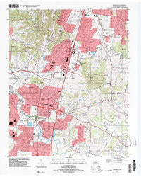
Franklin, Tennessee, USGS topographic map dated 1997.
Includes geographic coordinates (latitude and longitude). This topographic map is suitable for hiking, camping, and exploring, or framing it as a wall map.
Printed on-demand using high resolution imagery, on heavy weight and acid free paper, or alternatively on a variety of synthetic materials.
Topos available on paper, Waterproof, Poly, or Tyvek. Usually shipping rolled, unless combined with other folded maps in one order.
- Product Number: USGS-5334424
- Free digital map download (high-resolution, GeoPDF): Franklin, Tennessee (file size: 13 MB)
- Map Size: please refer to the dimensions of the GeoPDF map above
- Weight (paper map): ca. 55 grams
- Map Type: POD USGS Topographic Map
- Map Series: HTMC
- Map Verison: Historical
- Cell ID: 16249
- Scan ID: 143922
- Imprint Year: 2002
- Woodland Tint: Yes
- Aerial Photo Year: 1997
- Datum: NAD83
- Map Projection: Universal Transverse Mercator
- Map published by United States Geological Survey
- Map Language: English
- Scanner Resolution: 600 dpi
- Map Cell Name: Franklin
- Grid size: 7.5 X 7.5 Minute
- Date on map: 1997
- Map Scale: 1:24000
- Geographical region: Tennessee, United States
Neighboring Maps:
All neighboring USGS topo maps are available for sale online at a variety of scales.
Spatial coverage:
Topo map Franklin, Tennessee, covers the geographical area associated the following places:
- Jamestown - Country Wood Estates - Hallbrook - Saratoga - Brentwood South - River Club Estates - Brenthaven South - Royal Oaks - Buckingham Park - Chestnut Hill - Riverview Park - Breckenridge South - Clovercroft - Cadet - Stonehenge Estates - Foxboro Estates - Brenthaven North - Maplewood - Moores (historical) - Carnton Plantation - Liberty Hills - Callender (historical) - Brenthaven East - Leeland - McGavock (historical) - Highgate - Eldorado Acres - Crockett Hills - Wikles (historical) - Stevens Shop (historical) - Walnut Hills - Country Roads - Landings - Millview - Ewingville - Rolling Rivers - Brentwood Hills - Indian Point - Carpenters (historical) - Deerfield - Owens (historical) - Indian Springs - Yorktown - Mudsink - Twin Springs Estates - Gardner Estates - Franklin - Oakleaf Estates - Lynnwood Downs - Crockett Cove - Brentwood Pointe - Hill Estates - Redwing Farms - Boxwood Hall - Cross Creek - Crockett Springs - Concord Country Estates - Trinity - Sturbridge Pointe - Mooreland Estates - Oakwood Estates - Spencer Creek Place - Carriage Hills - Charleton Green - McEwen (historical) - Franklin East
- Map Area ID: AREA3635.875-86.875-86.75
- Northwest corner Lat/Long code: USGSNW36-86.875
- Northeast corner Lat/Long code: USGSNE36-86.75
- Southwest corner Lat/Long code: USGSSW35.875-86.875
- Southeast corner Lat/Long code: USGSSE35.875-86.75
- Northern map edge Latitude: 36
- Southern map edge Latitude: 35.875
- Western map edge Longitude: -86.875
- Eastern map edge Longitude: -86.75


